Batchewana, ON
Gap Filler Site
Click on the description text to view the photograph.
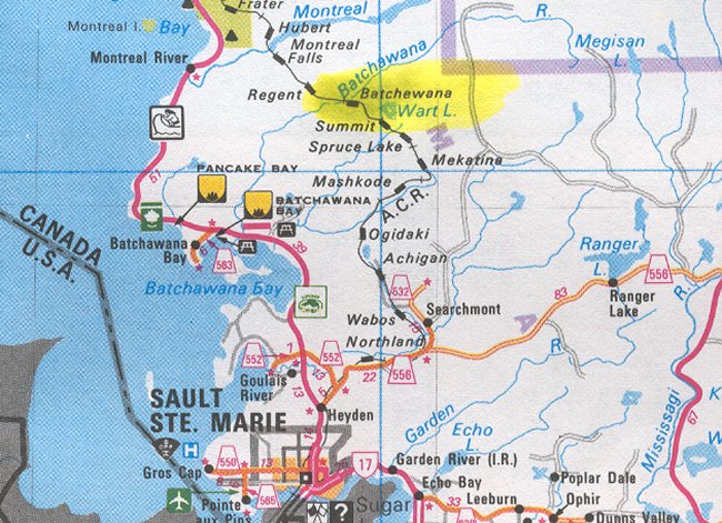
Map showing the location of Batchewana north of Sault Ste. Marie - 29 May 2002.
Courtesy Ontario Ministry of Transportation.
Requirement for Farm Type Gate on Access Road - 24 June 1963
Courtesy National Archives of Canada.
Care & Custody: Construction Status - 17 September 1962
Courtesy National Archives of Canada.
Gap Filler: Batchewana - 9 August 1962
Courtesy National Archives of Canada.
Land Acquisition: Site & Access Road - 2 August 1962
Courtesy National Archives of Canada.
Status Report on Batchewana - 31 July 1962
Courtesy National Archives of Canada.
Reservation of Armco Steelox Components - 2 May 1961
Courtesy National Archives of Canada.
Design Criteria for Standard Buildings - 14 Oct 1960
Courtesy National Archives of Canada.
Preliminary CE Report & Cost Estimates - 1960
Courtesy National Archives of Canada.
Photographic Credits
All photos are used with permission.
Return to the Details Page
Index
Return to Top of Page
Updated: December 5, 2004