Click on the description text to view the photograph.
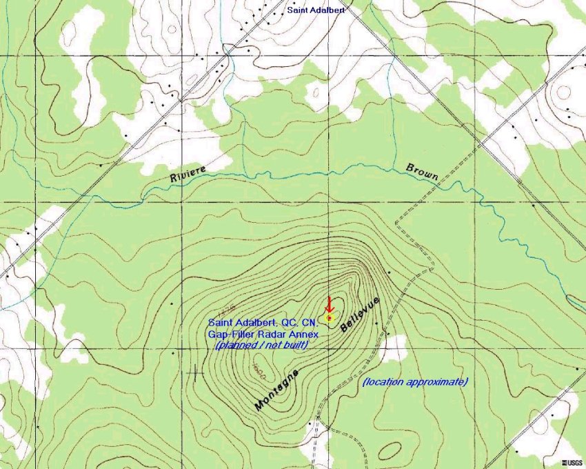
- Topo map showing the proposed location of the St. Adalbert Gap Filler site.
Courtesy Tom Page.
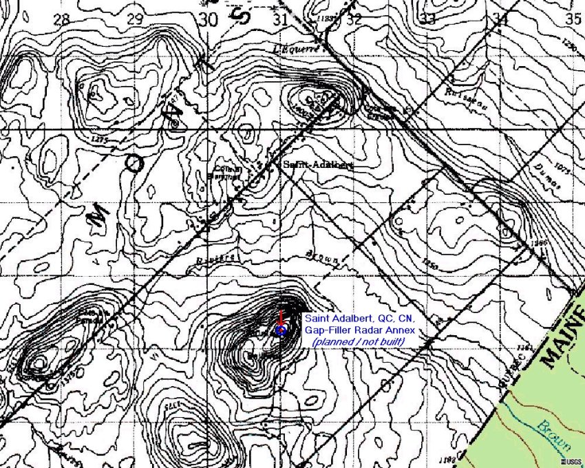
- Topo map showing the proposed location of the St. Adalbert Gap Filler site.
Courtesy Tom Page.
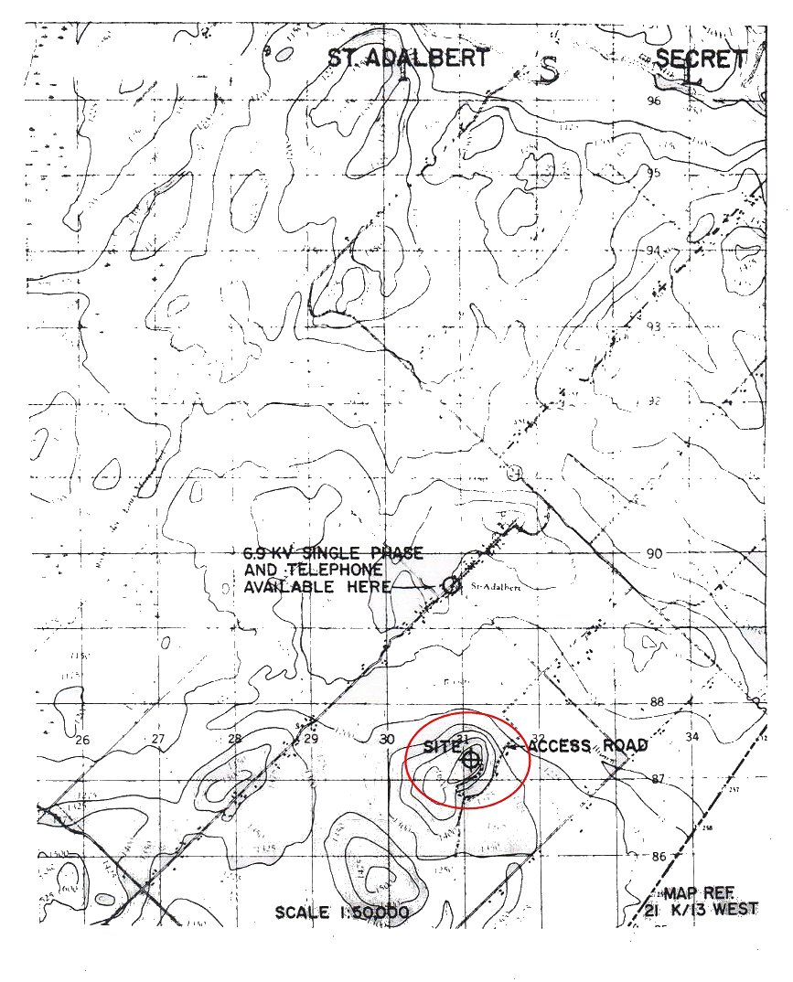
- Land Acquisition: Site & Access Road - 2 August 1962
Courtesy National Archives of Canada.
- Reservation of Armco Steelox Components - 2 May 1961
Courtesy National Archives of Canada.
- Detail pertining to the Gap Filler site at St. Adalbert - 31 March 1961
Courtesy National Archives of Canada.
- Map showing the proposed location of the Gap Filler site at St. Adalbert - 31 March 1961
Courtesy National Archives of Canada.
- Field Survey: St. Cecile - 24 June 1959
Courtesy National Archives of Canada.
|