Memories of Troposcatter at Resolution Island
Walt Mitchell
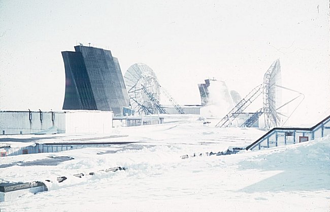
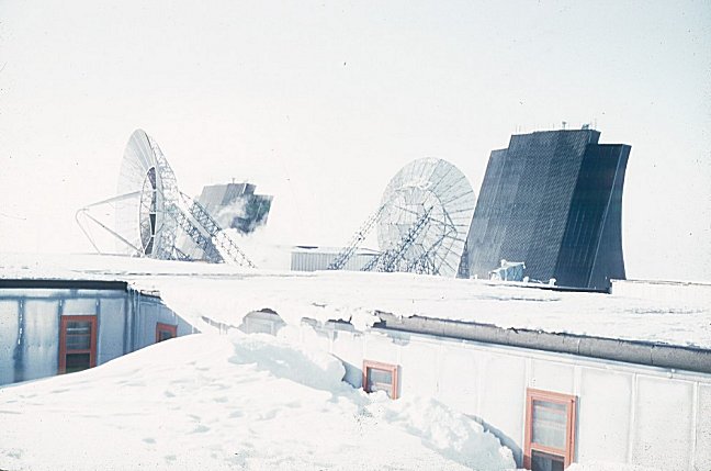
The Troposphere is approximately 12 miles above the earth. That is where the common area, as described in another article, is located. The theory around the Troposcatter idea was to use very high powered transmitters ( 1, 10, 50 and 100 Kilo Watt). When the radio energy hits the Tropo, the vast majority continued through the Tropo but some was scattered back toward earth where it was received by very sensitive receivers. The hops could be in the hundreds of miles. The greater the distance, the higher the power. Most of the links on the extension of the Pinetree Line were 10 KW.
Polevault was the very first use of this concept and led to wide spread use throughout the world, including the DEW Line to mention just one. The radio equipment was manufactured by Radio Engineering Labs on Long Island, New York, USA. The refinements made to the equipment was seen in the BMEWS Rearward system installed at Resolution Island in the early sixties.
The Polevault system at Resolution Island had two paths between Goose Bay and Resolution for redundancy purposes and channel capacity. There was only one path to Frobisher. On Resolution, another link from what was called Res X shot to Brevoort Island also called ResX1 and then on to Cape Dyer on the DEW Line. The BMEWS Rearward link came from Thule to Dye to ResX1 to ResX on Resolution and then on to Goose Bay. I suspect that was the link maintained by Canadian Marconi under contract in the 1961 to 1974 period.
In the following photos, the Polevault antennae are all parabolic dishes. The BMEWS antennae are billboard type that were more suited to the harsh environment. One of the parabolic antennas to Frobisher was blown over in an ice storm and replaced prior to my arrival in 1960. The loss of that antenna had us taking hammers and knocking the ice accumulation off. The short straw got that job!
|
In one of your photos on the web, unknown antennae are mentioned. There were 30 foot antennas at the ResX site on Resolution which were not located in the main Tropo radio area but detached near the garage. Those fellows had to don Arctic gear to make the trip to their work site where the Polevault area was connected to the main site by hallways. I can remember not going outside for three months. During the month of December 1960, I worked the 8:00pm to 8:00am shift, seven days a week. Due to the short Arctic day, I did not see any sunlight for the entire month.
Updated: April 25, 2000