As I mentioned on the previous page "That may be how the story goes - but that story sounds like a plot for the next "Harrison Ford" movie". The actual details are as follows:
|
Aircraft Identification: |
Canso A Tail Number 11007 |
|
RCAF Unit and location: |
RCAF Station Alliford Bay, BC, Number 6 (BR) Squadron |
|
Location of Crash Wreckage: |
3 miles west of Tofino airfield. - 49.04.40N 125.49.11W |
|
Date of crash: |
February 8, 1945 |
|
Details of Crash: |
Aircraft left Tofino for Coal Harbour, with 12 aboard, but shortly after becoming airborne the port engine stopped and the aircraft crash landed 3 miles off the end of runway 28. The occupants escaped. SAR notified wreck was to be salvaged by private party 21 Feb 66, but recent reports indicate wreck still at site. |
|
Crew and Passengers: |
Pilot: F/O RJ Scholes; Co-Pilot: F/O LC Laker; F/O EE Knechtel; P/O CC Sartouris; WO2 LH Malcomston; WO2 JB Campbell; WO2 CH Henningsen; F/Sgt. RW Hacker; Sgt. RF Bell; Sgt. WA Hooge; AW1 RJ Pike; Mr. DF Marlett |
This detail has been obtained from a book called "Jerico Beach and the West Coast Flying Boat Stations", by Chris Weicht, ISBN 0-9681158-0-2, page 276.
It is safe to say that we are now progressing with facts. We have determined the aircraft identification and tail number; the unit and location of unit; the location of the crash wreckage; the date and details of the crash, and most important, a manifest of the passengers who were on board at the time of the crash
I guess the next thing to do is to provide you with some sort of an indication as to the exact location of the crash wreckage. This can best be accomplished as follows:
|
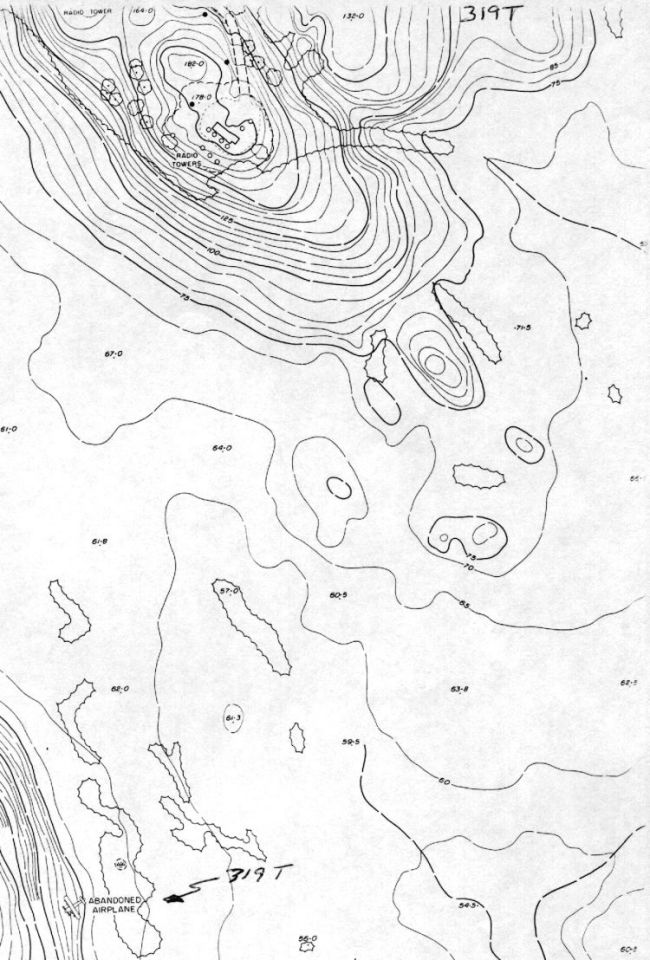
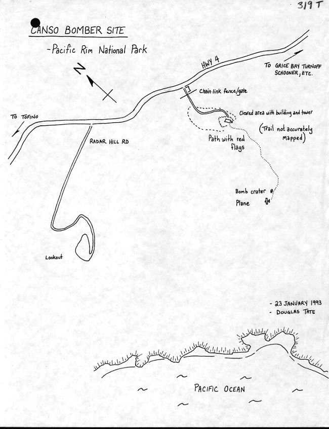
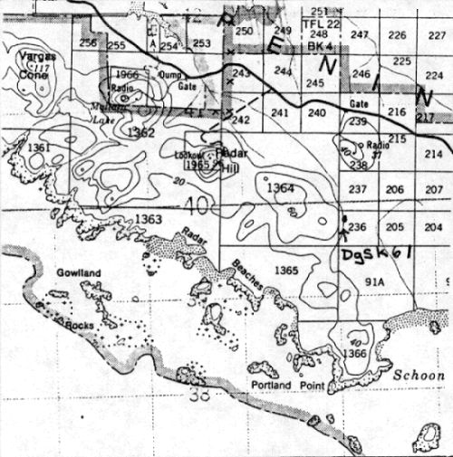
Location and Access: Clayoquot Land District Lot 237, Long Beach Unit. The site is about 1.5 km ESE of the Radar Hill Lookout.
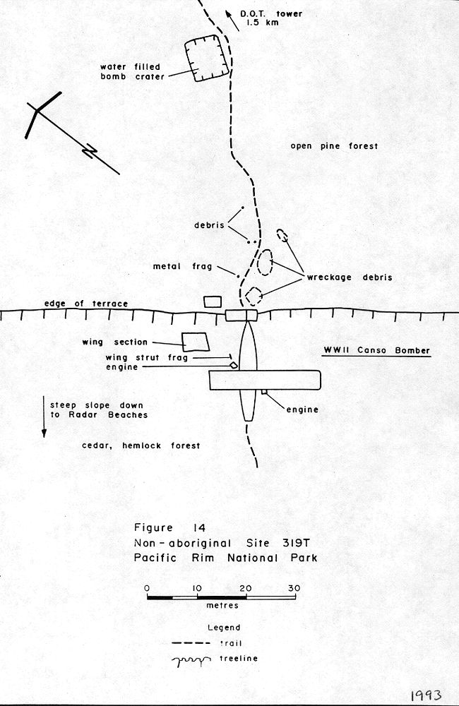
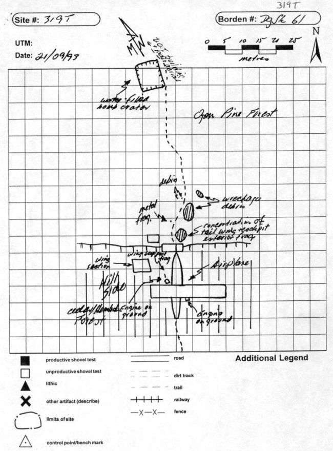
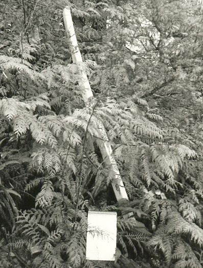
Access by Vehicle: Proceed west on highway 4 about 4 km west of Grice Bay turnoff. Park outside the gateway to the abandoned DOT radio tower/building. Walk around the metal chain link fence and follow the road up to the DOT building and aerial. The trail begins by the new aerial on the far side of the building. Follow the flagged trail SSW for approximately 1 km. The bomber is at the base of a hill, 40 meters SW of an 8 by 9 meter bomb crater.
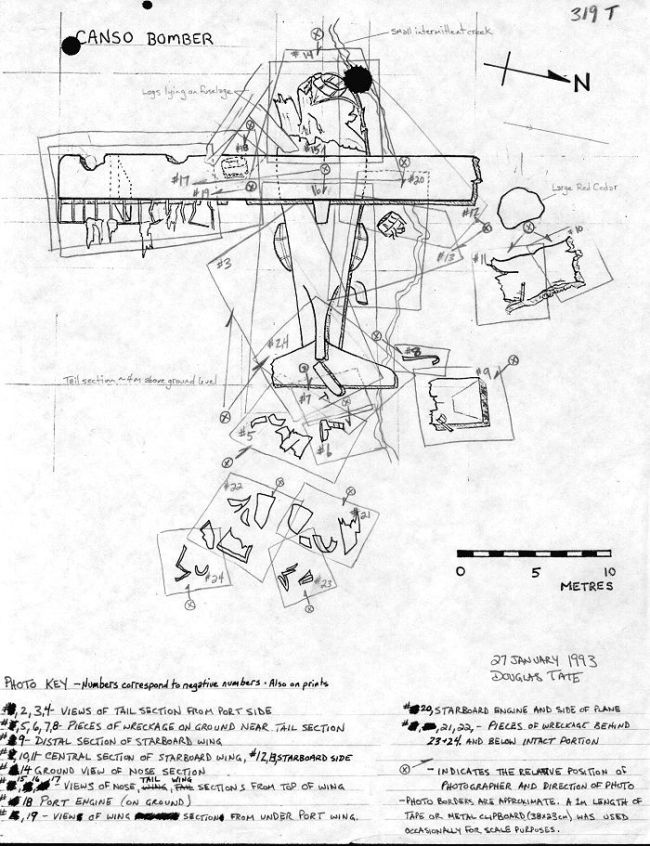
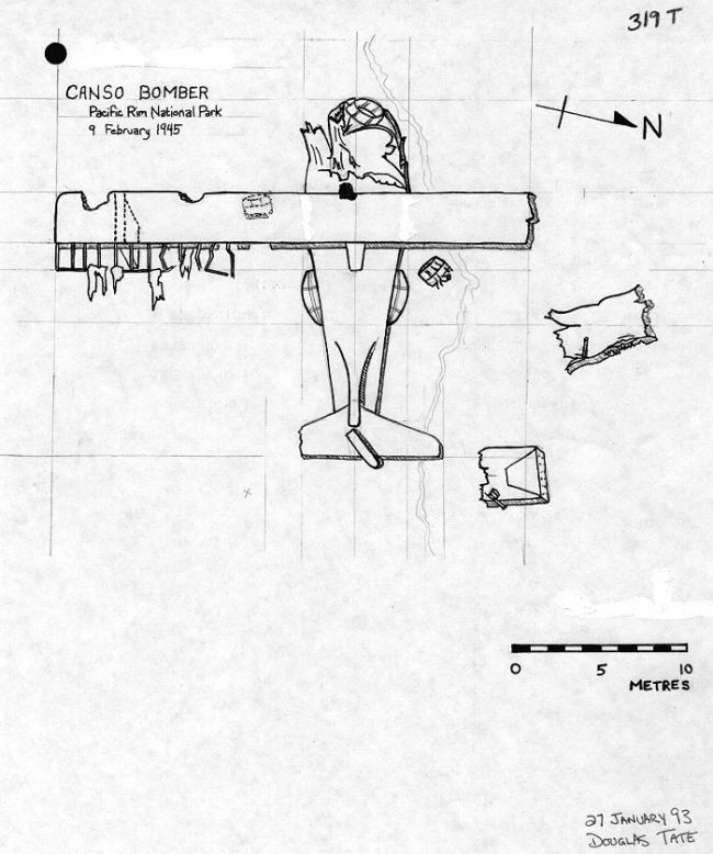
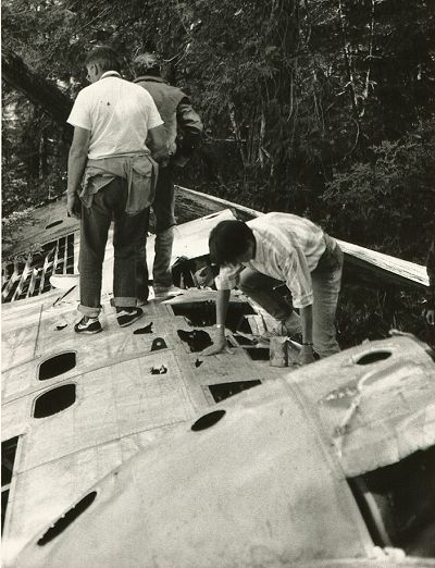
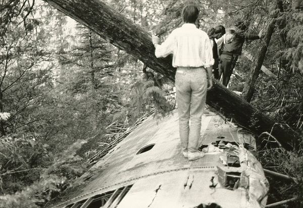
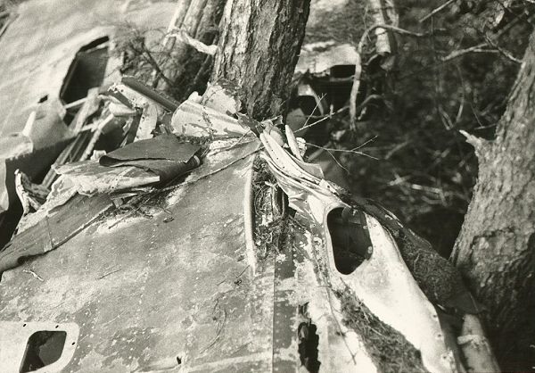
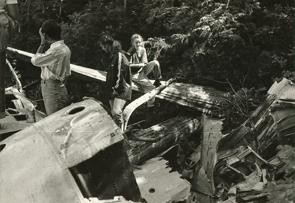
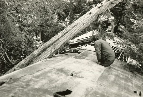
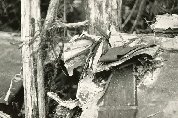
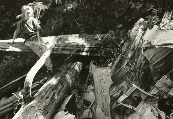
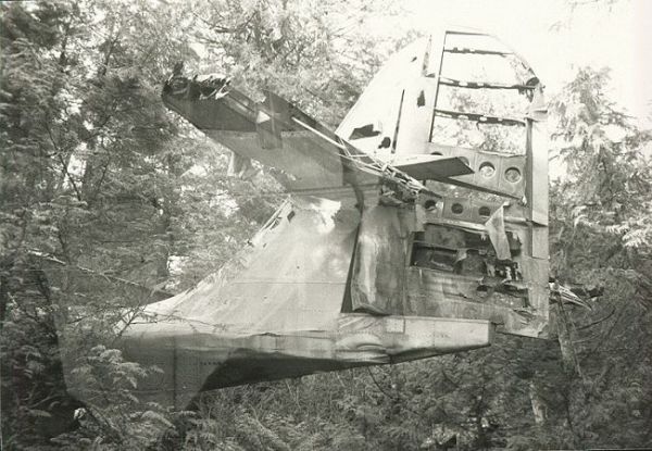
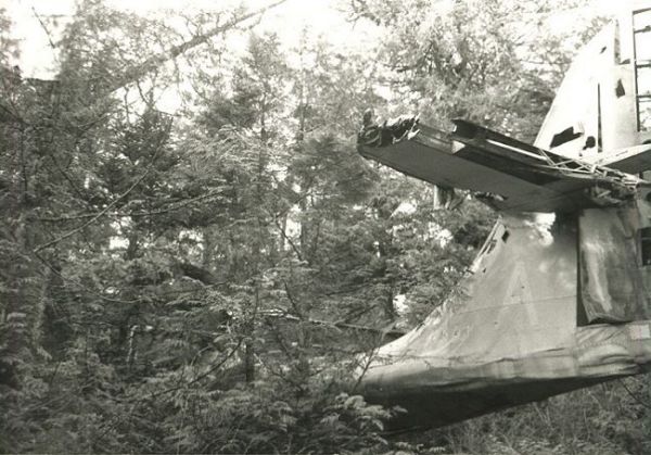
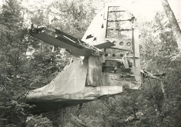
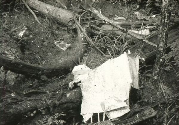
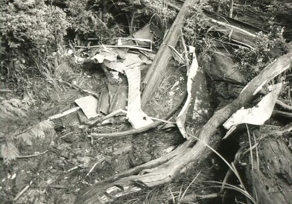
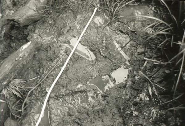
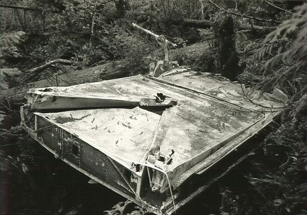
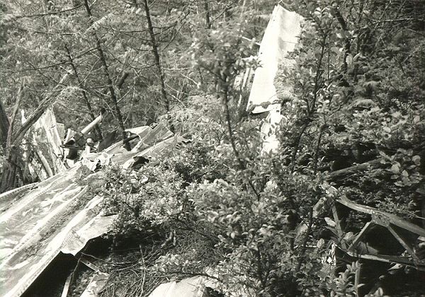
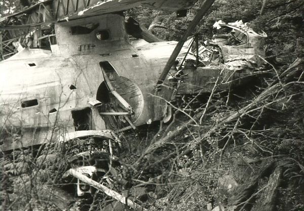
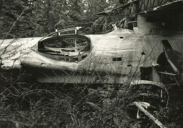
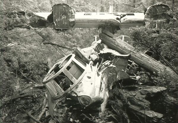
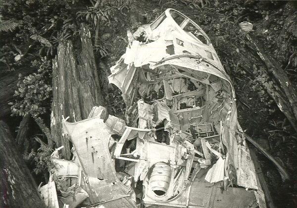
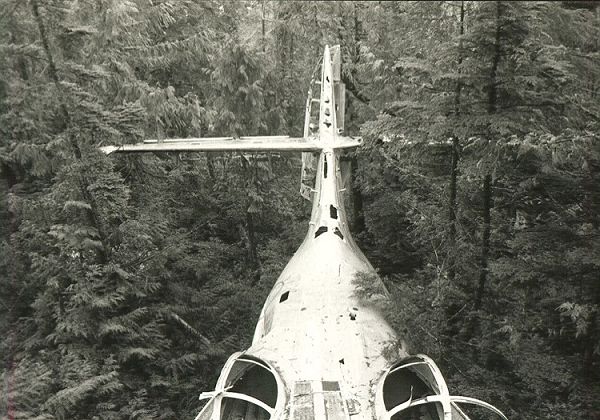
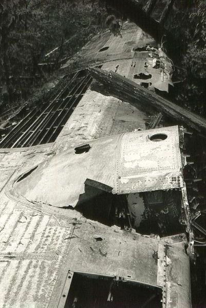
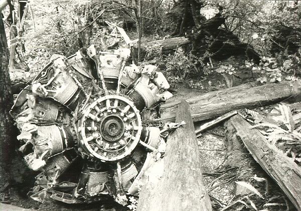
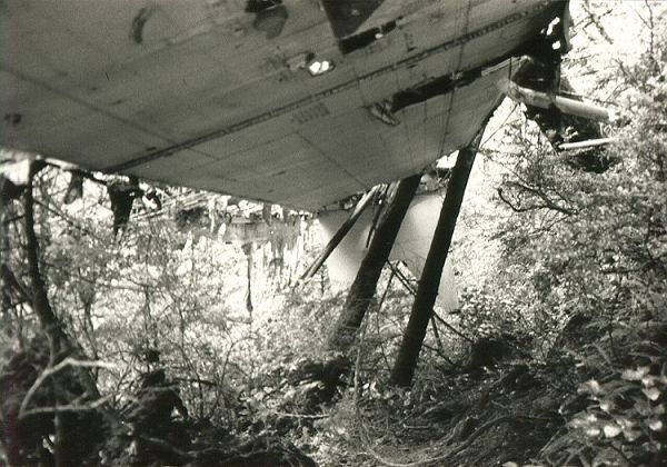
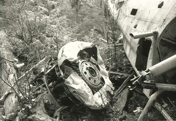
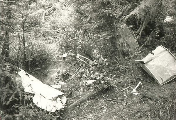
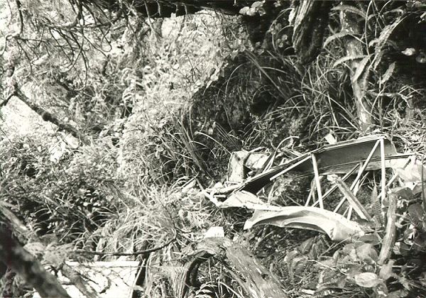
Remains: The aircraft's fuselage is still intact and is surrounded by metal wreckage debris. An 8 by 9 meter water filled crater occurs approximately 40 meters northeast of the wreckage. The bomber sits upright. The cockpit area is severaly damaged and the right wing and left tail wing are partially intact. The site is popular with locals, and as such, a number of the plane's interior fittings and gear have been removed off site. Because the plane is manufactured from aluminum, natural deterioration is occurring at a slow rate.
The Start: The abandoned building on the hilltop served as a transmitter from the early 1950's. Do not enter the building - It is potentially dangerous. Samples of paint and wall/floor covering are being tested for lead and asbestos contamination. The building is empty, dark and strewn with broken glass from vandals.
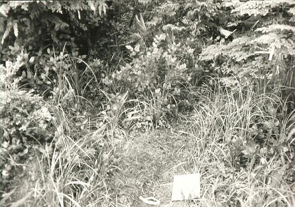
Getting to the Wreckage: Hiking to the Canso bomber wreck? Read this before proceeding any further. Every year increasing numbers of people are going to this site. As a result the unofficial trail to the bomber is becoming wider, muddier and more and more vegetation is being damaged by users trying to skirt the mudholes. If the damage increases the Pacific Rim National Park may be forced to close the trail. You can help minimize damage to the environment. DO NOT proceed if you are not wearing rubber boots. People trying to avoid mud have damaged the environment by skirting the existing trail. The result is a confusing and damaging network of parallel routes. Walk in the mud of the most damaged trail and allow the less used trails to recover.
At the Wreckage: Remember this is a designated archaeological site. Do not move, remove or deface any part of the plane. Please do not add your graffetti to the wreck. Be careful at the plane. The metal wreckage can be very sharp and slippery.
We have provide detail on the location, and how to get there. The unanswered question - what will we find when we arrive? This is quite difficult to answer. As already indicated, there are increasing numbers taking the trek to the downed Canso every year. While I prefer to think all is well, there are a few facts which can not be overlooked. (a) The Canso crashed in 1945. (b) Visitors have been going to the site of the wreck in ever increasing numbers, and as a result - pieces of the wreckage continue to disappear. (c) There has been ongoing correspondence from various groups over the years to completely remove the remains from its existing location. With this in mind - I really have no way of knowing what you may find - should you ever decide to visit the site.
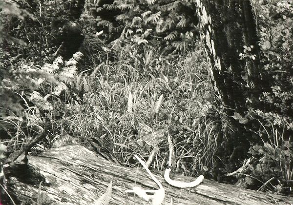
Having said all of this, I would like to move on and provide some additional photos of the wreckage.
We have provided detail on the location - and have also provided you with an assortment of photographs. It's now time to provide you with written detail and documentation. We hope that you enjoy the following articles.
|
This page is located at
http://www.pinetreeline.org/other/other43ad.html
Updated: April 25, 2000