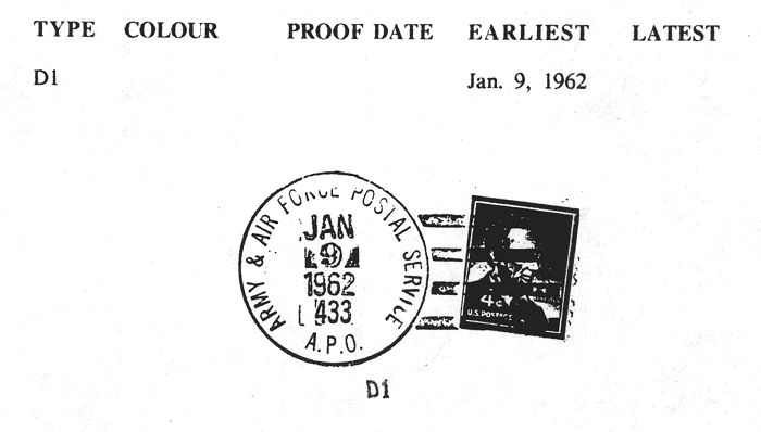
US APO 433 NEW YORK – CARTWRIGHT, LABRADOR
Latitude:
Longitude:
56 degrees 58 minutes West
Population:
753 (1971)
Origin of Name:
Named after George Cartwright, a British trader on the Labrador cost in the 1700s.
In 1951 the United States and Canada agreed to extend the Continental Air Defence Integrated North (CADIN)-Pinetree Line into Northern Canada. The Pinetree Line was a series of radar sites to warn of incoming aircraft and to guide interceptors to their targets.
Opened: July 1, 1959 - Mailing Address Only (Parent Office New York)
-------------July 1, 1962 - Full Post Office
-------------January 1, 1965 (Changed to APO 09433)
References:
Howey 1968, Shaffer 1985
Units Suspected:
922nd Aircraft Control and Warning Squadron
922nd Det #1 Aircraft Control and Warning Squadron, Cut Throat Island, Labrador
922nd Det #2 Aircraft Control and Warning Squadron, Spotted Island, Labrador
Detachment #8, 1932nd Communications Squadron (AFCS) (Polevault Communications System)
Kevin O’Reilly made this detail available for use on the Pinetree Line web site in December, 1998. He would like to communicate with anyone on this topic and he would appreciate receiving information about this aspect of the Pinetree Line. Kevin can be reached at:
xcarc@ssimicro.com