Pagwa, ON
Photographs


Click on the description text to view the photograph.

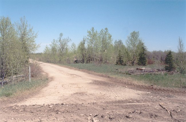
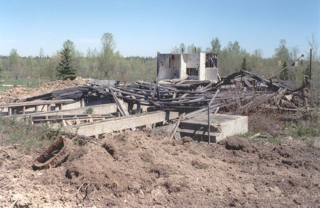
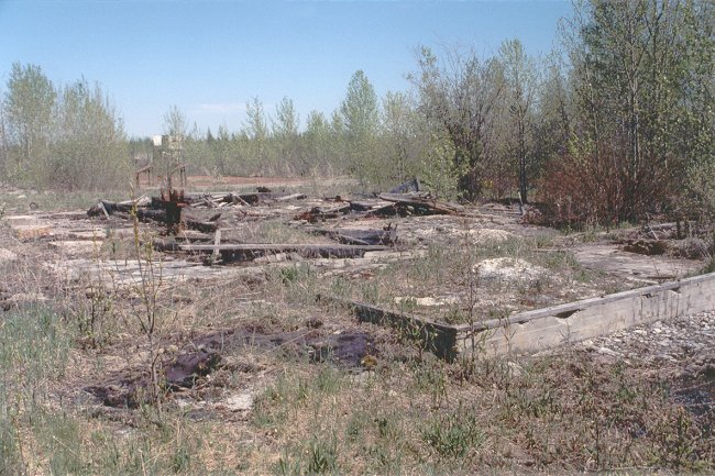
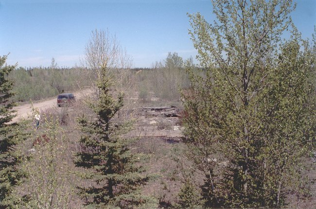
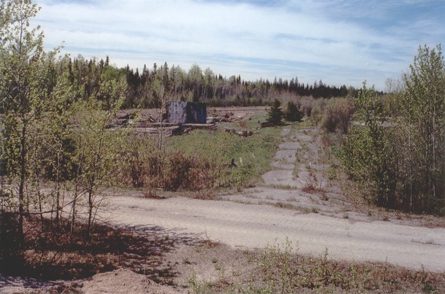
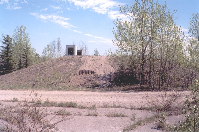
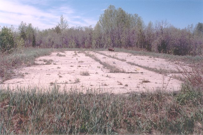
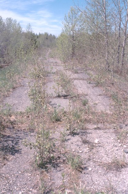
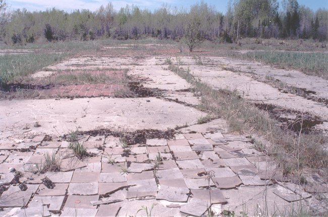
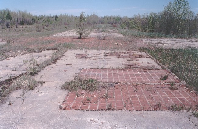
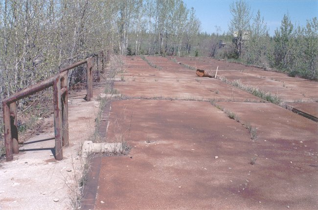
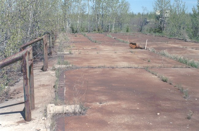
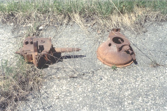
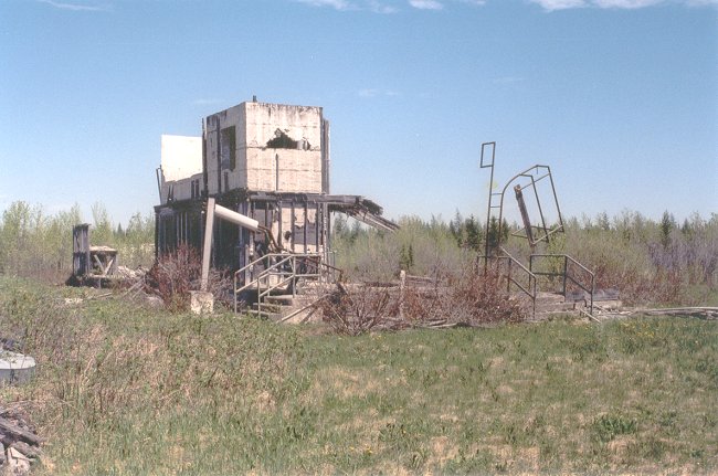
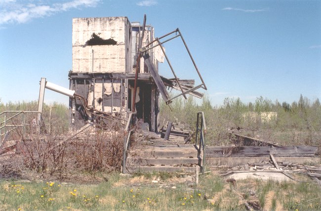
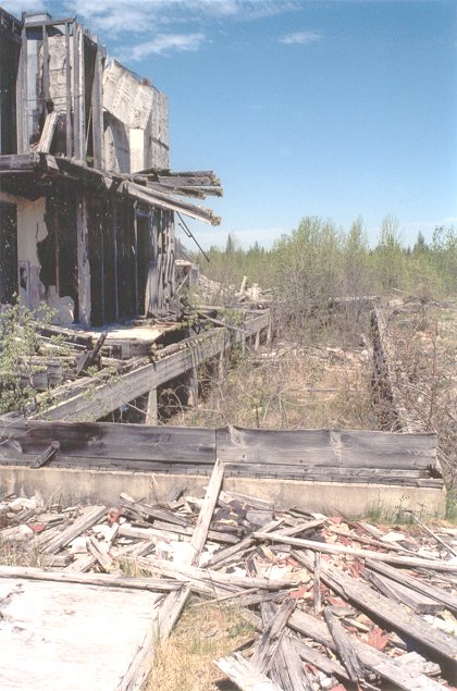
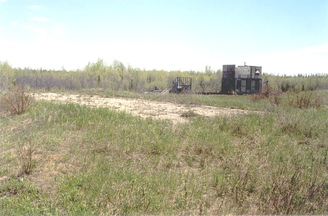
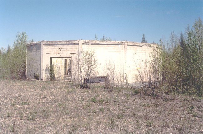
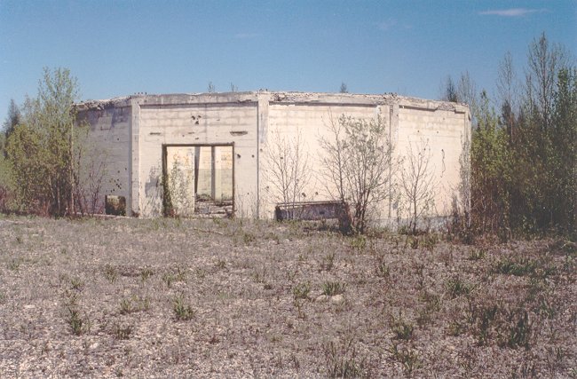
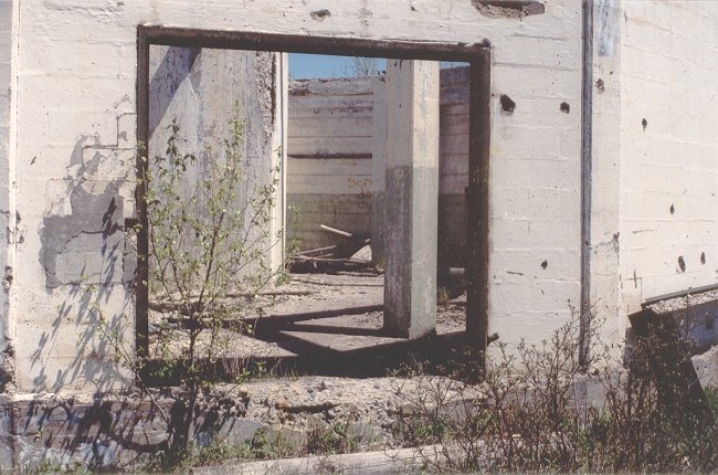
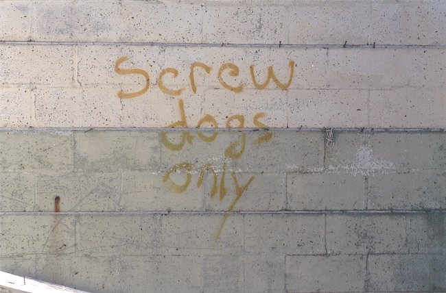
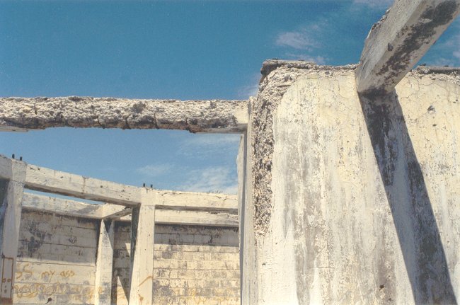
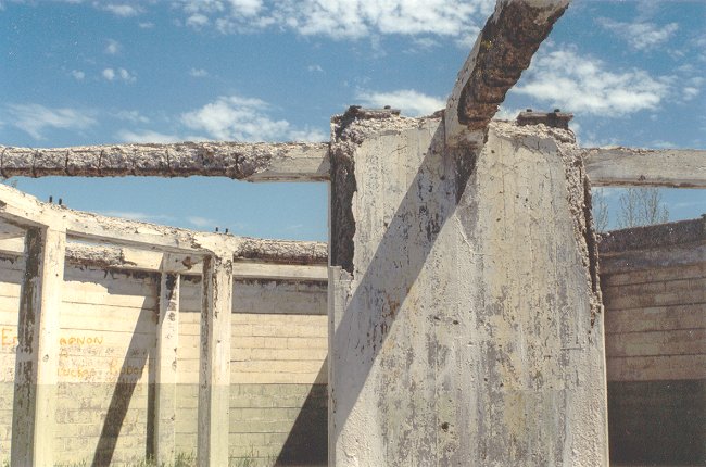
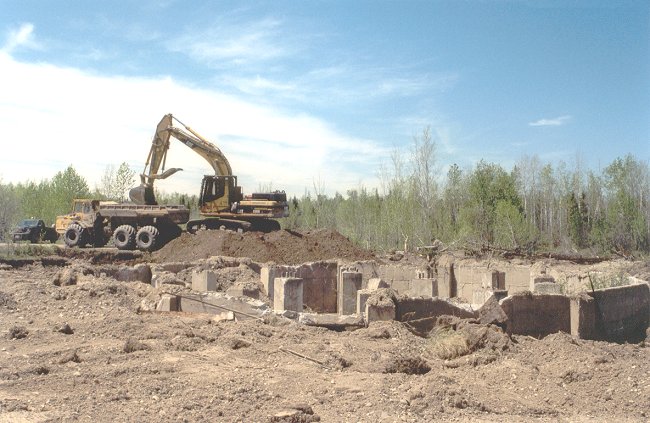
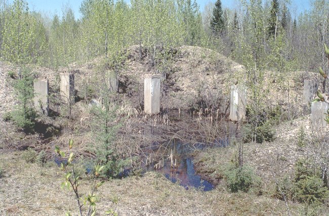
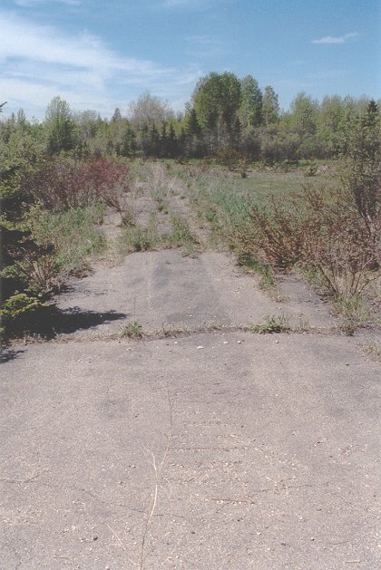
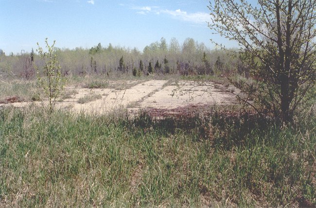
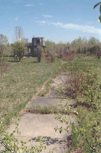
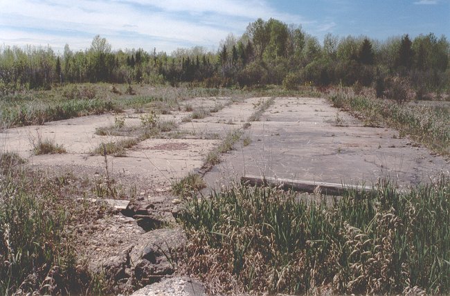
    We must bear in mind that the radar station at Pagwa was closed on 1 October 1966. There was really no way to know what might remain, but it was safe to assume that there would be little, if anything, still in the area to remind the visitor of what once existed at this location.

  1. The main entrance to the Pagwa radar station - 13 June 2002.
    This location is a mile and a half west of the Pagwa River. The main gate was located where the debris lies at right. The tree growth continues to swallow the remains of the site.
    Courtesy Richard Cameron.

  2. A forest access road is being constructed in front of the original radar station - 13 June 2002.
    Courtesy Richard Cameron.

  3. A Volvo haulage truck emerges from the station confines with a load of gravel for roadbuilders - 13 June 2002.
    Courtesy Richard Cameron.

  4. Another view of the Volvo truck as it approaches the intersection - 13 June 2002.
    Courtesy Richard Cameron.

  5. The remains of an unidentified building with concrete foundation near the main gate - 13 June 2002.
    This building is not shown on early aerial photographs. It was built on a diagonal to other station structures and appears to have been two stories tall and contained bathroom facilities. Some gravel has already been removed from this area.
    Courtesy Richard Cameron.

  6. A concrete slab foundation just north of the main gate - 13 June 2002.
    If you look carefully, you can see what appears to be a typical "weather observation post" at the far left.
    Courtesy Richard Cameron.

  7. A view from the top of the water storage silo - 13 June 2002.
    The station is enveloped in tree growth and you can see the boom of a backhoe in the distance.
    Courtesy Richard Cameron.

  8. One of the shortest side roads from the main road - 13 June 2002.
    The railway right-of-way and the forest access road are in the background. This view is looking southwest.
    Courtesy Richard Cameron.

  9. The water storage silo - 13 June 2002.
    A test hole has been dug (in the foreground) to check the quality of the gravel.
    Courtesy Richard Cameron.

  10. A concrete slab foundation for one of the barracks - 13 June 2002.
    Courtesy Richard Cameron.

  11. Fire hydrants still remain in the area after all these years - 13 June 2002.
    Courtesy Richard Cameron.

  12. Another side street between barracks foundations - 13 June 2002.
    Courtesy Richard Cameron.

  13. This is a cruciform foundation slab with a tiled centre area - 13 June 2002.
    It is assumed that this is the foundation of what was once the Mess Hall.
    Courtesy Richard Cameron.

  14. Another view of the cruciform foundation slab - 13 June 2002.
    Courtesy Richard Cameron.

  15. Foundation slab of the Motor Pool and Garage - 13 June 2002.
    The stops for the large doors still remain.
    Courtesy Richard Cameron.

  16. Another view of the Motor Pool foundation slab - 13 June 2002.
    Courtesy Richard Cameron.

  17. The remains of a transmission and a bell housing from days gone by - 13 June 2002.
    Courtesy Richard Cameron.

  18. The big Volvo loader appears with another load of gravel - 13 June 2002.
    Courtesy Richard Cameron.

  19. Closer view of the Volver loader - 13 June 2002.
    Courtesy Richard Cameron.

  20. Another mysterios foundation and remains - 13 June 2002.
    This building does not appear in the original aerial photos, and it appears to be a duplicate of the one by the entrance to the station. There were a couple of entrances as indicated by the steps.
    Courtesy Richard Cameron.

  21. A differnt view of the same foundation - 13 June 2002.
    Courtesy Richard Cameron.

  22. Yet another view of the same foundation and remains - 13 June 2002.
    Courtesy Richard Cameron.

  23. Another view of the mysterious ruins with a concrete foundation slab in the foreground - 13 June 2002.
    Courtesy Richard Cameron.

  24. Remains of a radar tower foundation - 13 June 2002.
    Courtesy Richard Cameron.

  25. Another view of the same radar tower foundation - 13 June 2002.
    Courtesy Richard Cameron.

  26. A closer view of the remains of the radar tower foundation - 13 June 2002.
    Courtesy Richard Cameron.

  27. It is assumed that the graffiti was not there in the 50s and 60s - 13 June 2002.
    Courtesy Richard Cameron.

  28. An interior view of the remains of the radar tower foundation - 13 June 2002.
    Courtesy Richard Cameron.

  29. Another interior view of the remains of the radar tower foundation - 13 June 2002.
    Courtesy Richard Cameron.

  30. Gravel removal results in the destruction of a radar tower foundation - 13 June 2002.
    Courtesy Richard Cameron.

  31. Gravel removal results in the destruction of a radar tower foundation - 13 June 2002.
    Courtesy Richard Cameron.

  32. Concrete supports for what was obviously another radar tower foundation - 13 June 2002.
    Courtesy Richard Cameron.

  33. A storm sewer manhole remains 36 years after the station closed - 13 June 2002.
    If you looked down this manhole, you would notice water is still running through the junk that has been tossed in. The station is still well-drained.
    Courtesy Richard Cameron.

  34. A concrete pathway to one of the building sites - 13 June 2002.
    Courtesy Richard Cameron.

  35. Another roadway between buildings - 13 June 2002.
    Courtesy Richard Cameron.

  36. Another barracks concrete foundation slab - 13 June 2002.
    Courtesy Richard Cameron.

  37. A concrete path to that mysterious building - 13 June 2002.
    Courtesy Richard Cameron.

  38. Yet another barracks concrete foundation slab - 13 June 2002.
    Courtesy Richard Cameron.

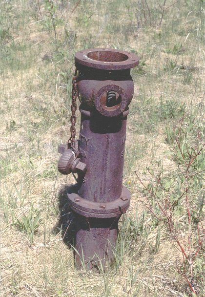
  39. And last, but not least, a second remaining fire hydrant - 13 June 2002.
    Courtesy Richard Cameron.

    As they would say in Hollywood, "That's a wrap". We now had to make a return trip across the bridge to the village of Pagwa River. Even though I have made the trip to Pagwa River about a dozen times, it was on the return trip that my wife spotted the Pagwa River cemetery. It was decided to take some additional photos along this trek and these can be seen in the last group available on the web site.

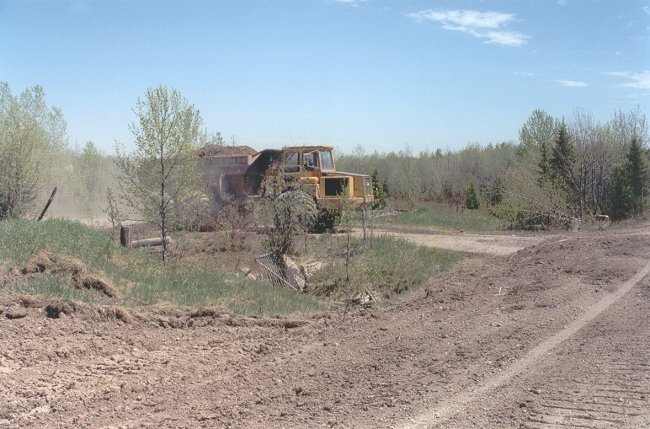
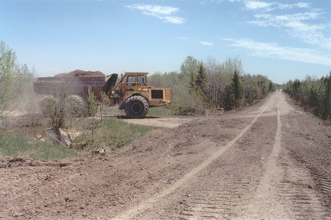
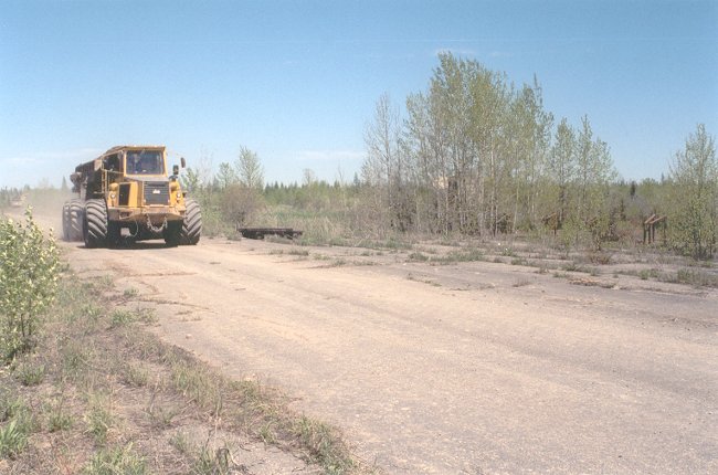
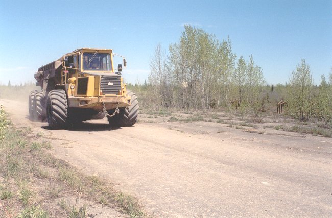
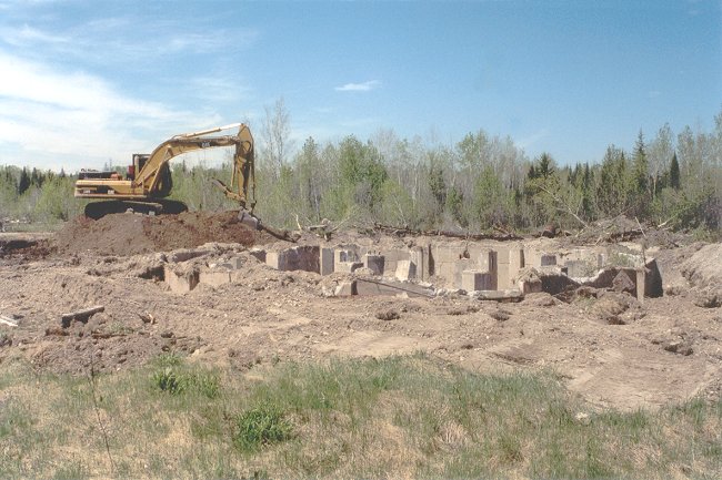
    On a somewhat sad note - it must be assumed that gravel, used for construction of forest access roads, will continue to be taken from the location of the radar station. Sould this be the case, we can not help but wonder exactly how much longer it will take, before all remains of the original Pinetree Line long range radar station which was located at Pagwa, totally disappears.


Photographic Credits

All photos are used with permission.


Return to the Details Page

Index
Return to Top of Page

Updated: August 10, 2002