December 1998
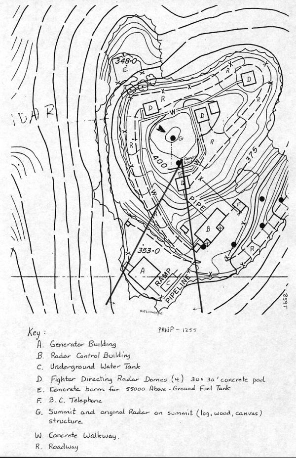
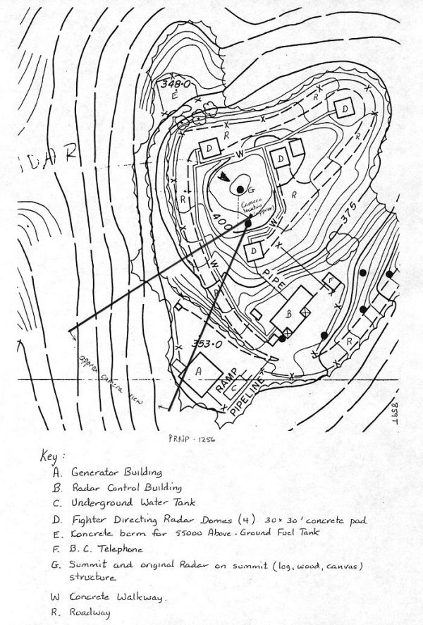
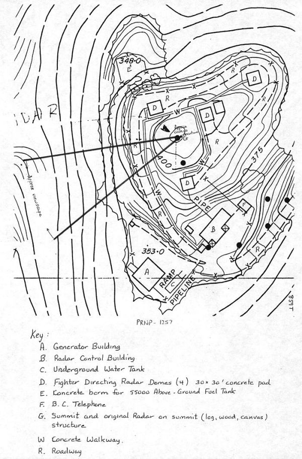
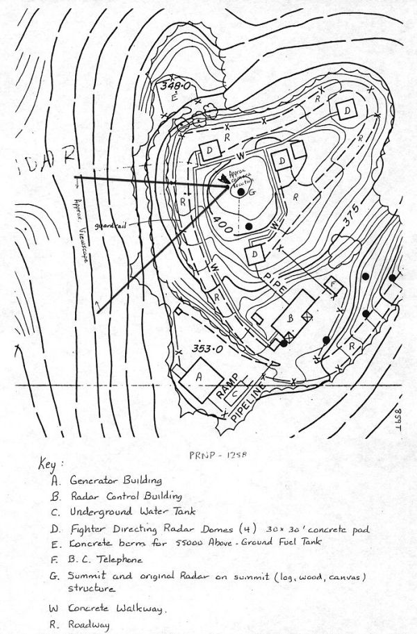
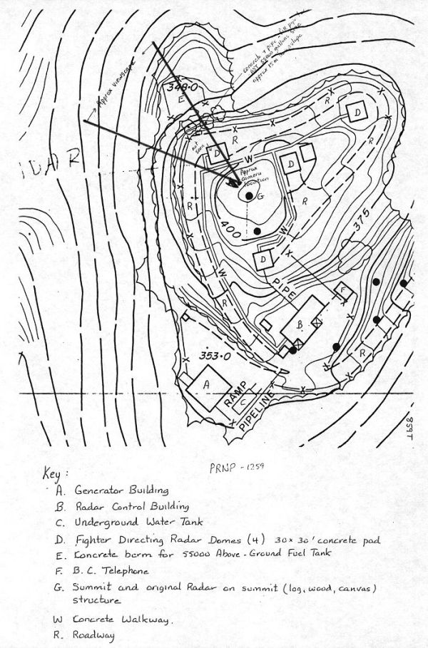
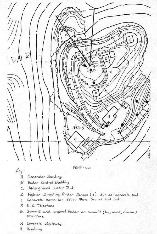
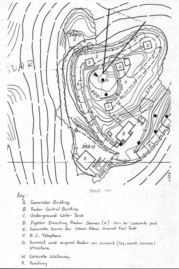
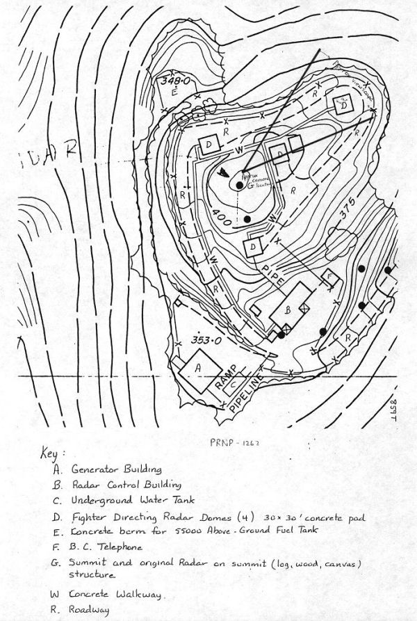
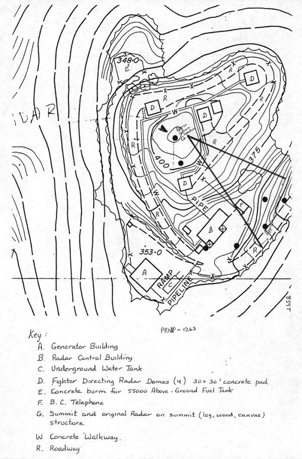
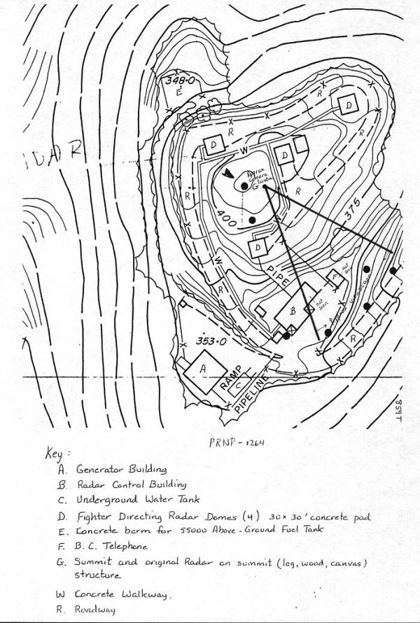
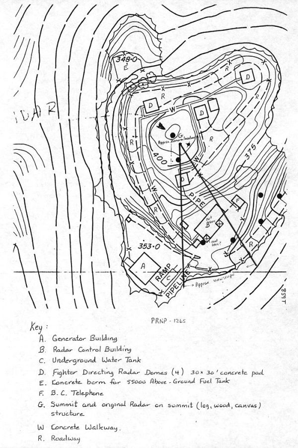
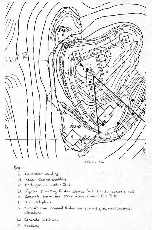
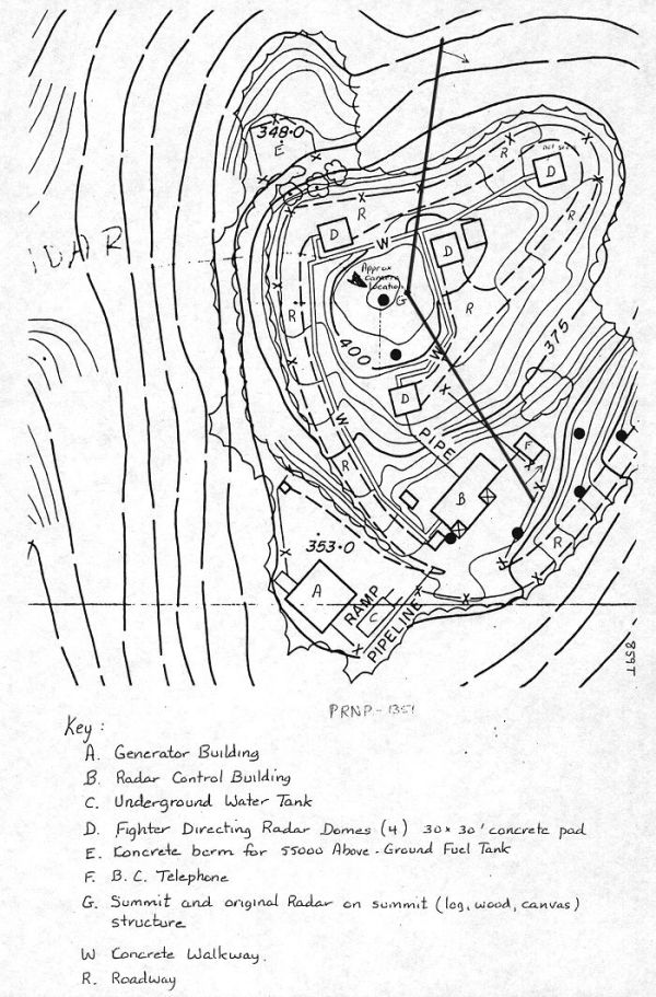
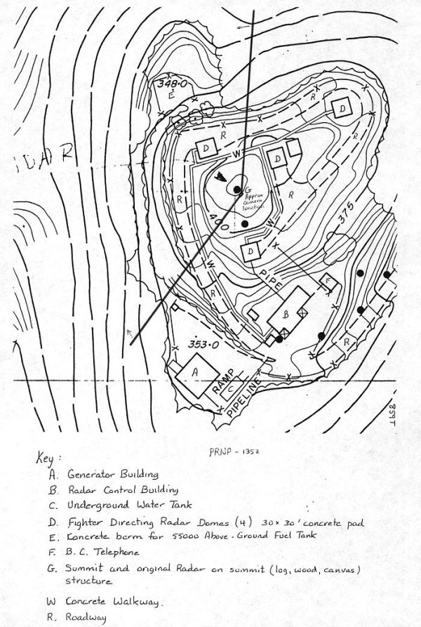
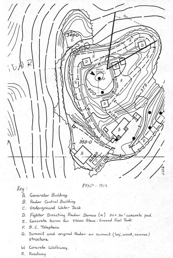
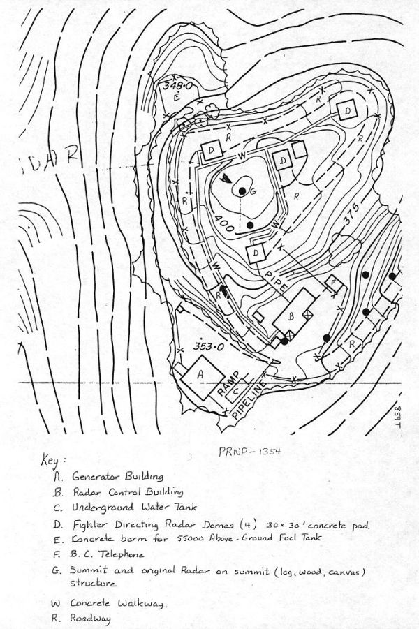
The Pacific Rim National Park (PRNP) has, through a series of interviews with personnel who worked in Tofino, managed to piece together a drawing of the Operations site. Our records indicate that construction commenced in the early 1950s, with a proposed activation date of January 1954. The station became operational on 15 Jan 55 and was closed in Dec 57. The operations buildings at the Operations site were dismantled in 1962. The Operations site diagram and the accompanying photos are a result of extensive work which was completed in 1970.
Examination of the PRNP Operations site drawing reveals the locations for the following buildings:
|
A |
Generator building |
|
B |
Radar Control (Operations) building |
|
C |
Underground Water Tank |
|
D |
Fighter Directing Radar Domes (Radomes) (4) 30x30’ concrete pad |
|
E |
Concrete Berm for 55,000 Above-Ground Fuel Tank |
|
F |
BC Telephone |
|
G |
Summit and original Radar on summit (log, wood, canvas) structure |
|
W |
Concrete Walkways |
|
R |
Roadway |
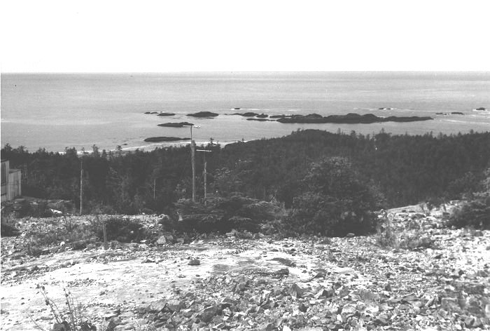
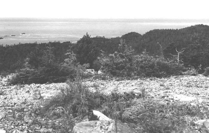
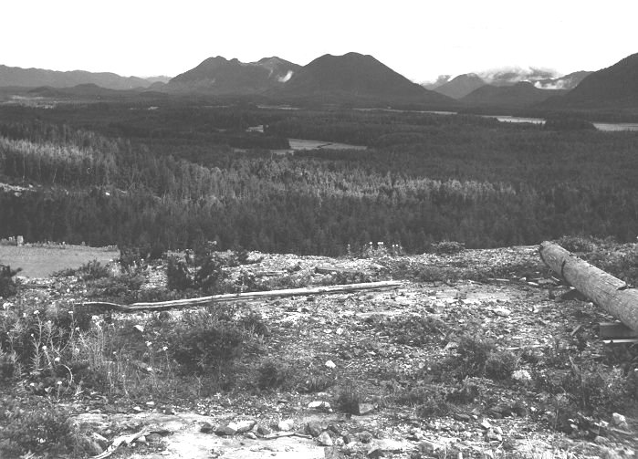
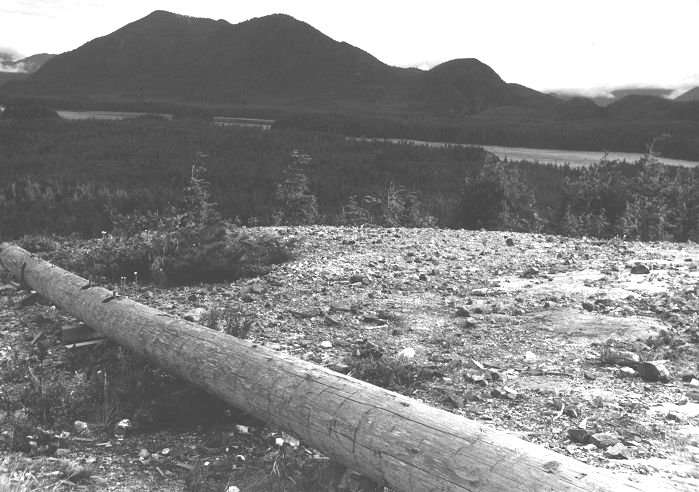
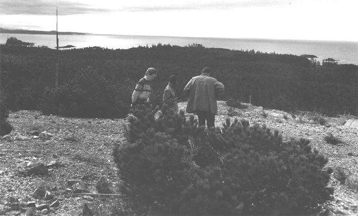
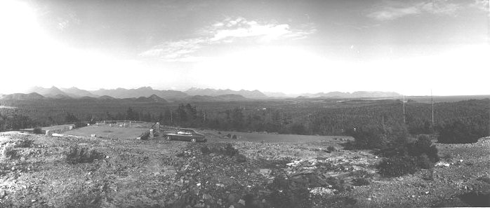
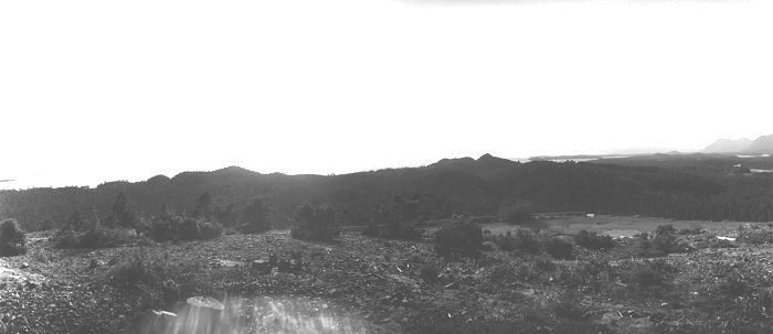
The following photos provide a 360 degree panoramic view of the area as taken on the summit. Almost all of the photos are combined with a drawing of the area that identifies the direction and viewscope of each photograph.
|
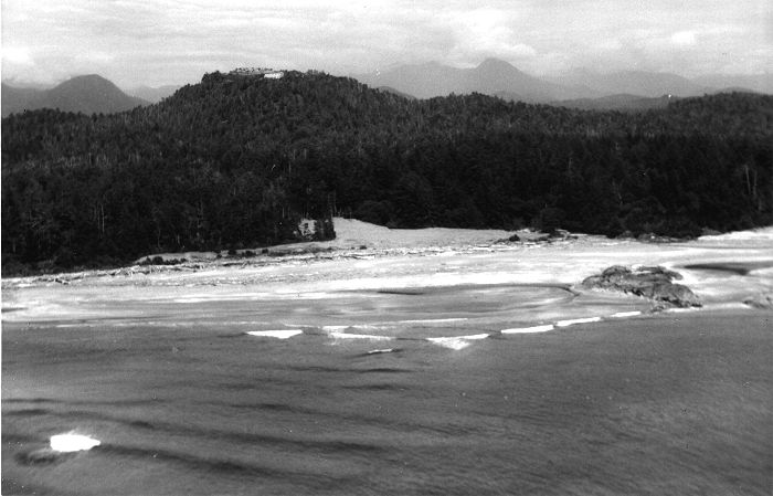
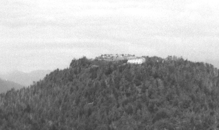
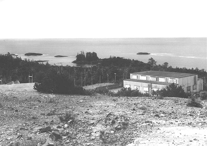
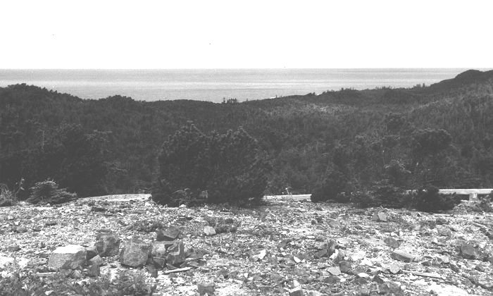
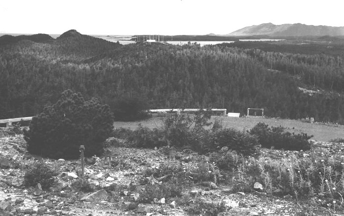
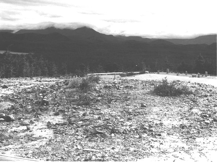
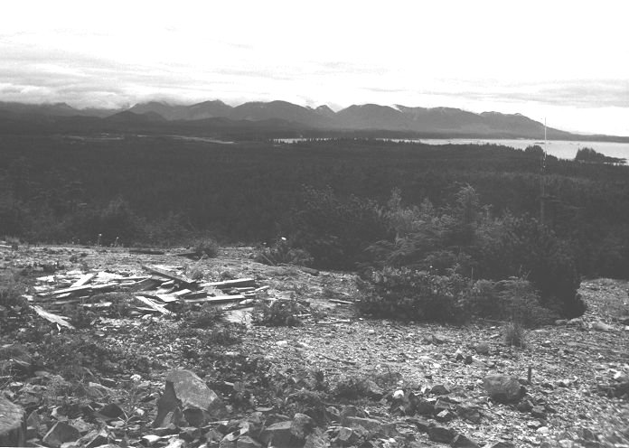
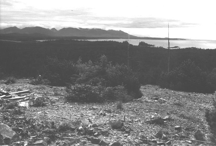
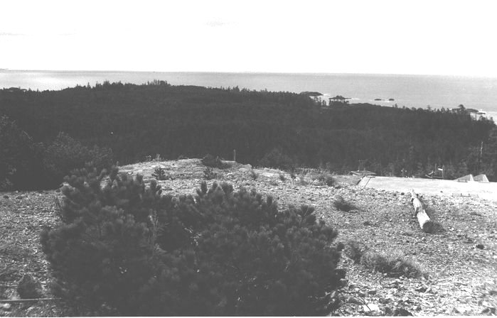
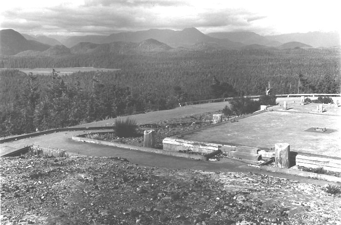
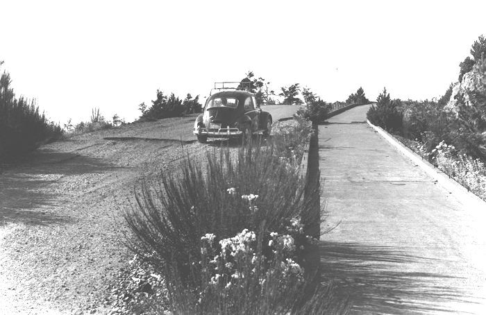
Aerial photo of Radar Beach and Radar Hill from plane flying over the water. Radar infrastructure on hill - white building is generator building - and lack of vegetation on hill area. Suspect the buildings were removed by 1972. Radar Hill summit view - south. Generator building right. Fuel tank berm (concrete) and mound, power lines, centre, radar dome pad and conduit (concrete) left. Fuel tank was large square concrete enclosed water tank. Radar Hill summit view - Gowlland Rocks and first radar beach foreground. Corner of Generator building (left) and 1950's vintage car - oil pump/surge valve enclosure and oil tank to right of vehicle. Radar Hill summit view - southwest approximately (west of Gowlland Rocks). Note extent of vegetation. Continuation of panoramic view. Radar Hill summit view southwest - Note portion of road up towards summit and log guardrail. Also not extent of summit vegetation. Continuation of previous panoramic view. Radar Hill summit view towards west. Cox Bay and Department of Transport Receiver site in background. Foreground - summit road with log guardrail. Staircase and oil tank inlet pipe juts right of centre (tank not visible - 15 m below inlet). Tank below was 55,000 gallon above ground storage tank (AST) enclosed in concrete berm. Continuation of panoramic view. Radar Hill summit view - northwest towards Tofino and Mt. Colnett (Meares Island) Foreground portion of summit road near a radar dome concrete pad (not seen). Pole on ground in foreground. Continuation of panoramic view. Radar Hill summit view north towards Mt. Colnett (Meares Island) Communications pole on ground. Note extent of summit vegetation. Continuation of panoramic view. Radar Hill summit view - northeast - Radar dome pad - concrete with some cut-off wood poles - is the one closest to the summit and was utilized as a wood decked viewing platform in the 1976 Park redevelopment of site. Beyond pad is a portion of the summit road (log guardrail). Continuation of panoramic view. Radar Hill summit view - northeast - Tofino airport in distance. Foreground - discarded lumber from radar facility at left. Communications pole on right. Note height and extent of summit vegetation. Continuation of panoramic view. Radar Hill summit view - east - Wickaninnish Bay. Foreground - lumber from previous facility (left), 2 communications poles. Note height and extent of vegetation. Continuation of panoramic view. Radar Hill summit view - southeast (Portland Point). Foreground - at right - concrete radar dome pad (1976 on - used as viewpoint and site of interpretive signs), conduit (U concrete channel), and portion of Control building (Roof only seen). Continuation of panoramic view. Radar Hill summit view - southeast - Wickaninnish Bay (left), Box Island (Schooner Cove) left edge, centre, Portland Point area, centre of photo. Nearby BC Telephone (?) aerials (left), concrete Radar building platform and part of rooftop Radar Control building (right edge) Unknown people in photograph. Note clarity of view (no trees). Radar Hill summit panoramic view (180 degrees) - left edge - South Bay and southeast corner of Meares Island. Right edge - Portland Point at west end Schooner Cove. View from very close to summit. Piping under rock rubble near centre. Building wood debris foreground, centre right. One of the two north facing dome building platforms ahead. Concrete walkway to platform left edge of photo. Summit road curls around summit shoulder from left and ends near right edge. Platform in scene is one covered by wood deck and used as a viewing deck since 1976. Photo taken from just north of summit and above building platform used as a viewing deck since 1976 (known as north view deck). MOT Transmitter Site centre of photo (white building). BC Telephone aerials (2) near right edge. From building and enclosure at north end of east parking lot. Tofino airport in view. Radar Hill summit - 180 degrees panoramic view from Gowlland Rocks (left edge) to Lone Cone, Meares Island (right edge). Foreground - cut log post (part of original, prototype Radar "Dome" of summit apex?). Access road rises uphill from left edge then "contours" around summit. Guard rail at road edge near drop off to Generator Building Parking Lot. West facing concrete platform near right edge is 1 of 4 platforms for later "Radar Domes" that surrounded summit but were not at the very top. This platform was decked with wood by Park in 1976 and had a plaque depicting the panorama from this deck (drawing of scene with place names). Concrete and metal "platform" immediately right of end of guardrail is top of pipe for filling huge station above ground fuel tank (55,000 gallon) that lay with a concrete berm 40 feet below road. MOT Receiver site with "forest" of aerials on hill to west. . Radar Hill summit view north. South Bay at left. Foreground - concrete platform north of summit and below summit. Platform was base for Radar Dome. Four 30x30 foot platforms built for Radar Domes (also another "Dome" on summit apex that appeared first). Concrete pathways to Radar Dome platform. These pathways and platform have been overgrown since 1976. This platform was used in Parks site redevelopment in 1976. Summit road curves around summit shoulder. Road comes from left and ends beyond right photo edge. Radar Hill summit - VW Beetle going up gravel road from parking lot/Radar Control building towards summit. Concrete base for covered walkway beside road. Part of road is asphalted. Peter Matrasous (WRO Park Planner) was involved in the gathering of detail for this project. The drawings and photographs were made available for use on the Pinetree Line web site by Barry Campbell of the Pacific Rim National Park. I wish to thank Barry for his assistance and support of the Pinetree Line web site. The drawings and the photos which were provided have managed to provide additional detail to the Pinetree Line radar station which was once located at Tofino. |
| Return to the Details Page |
| Index |
| Return to Top of Page |
Updated: March 11, 1999