Cape Scott, BC
Cape Scott, BC
Site #:
10 Radio Unit
Type:
Low-Flying Early Warning Radar
Callsign:
Construction Dates:
Start - 1942
End - 1942
Operational Date:
5 February 1943
Location:
Map #1
--
Map #2
Radar Equipment:
Closure Date:
19 September 1945
Click on the description text to view the detail.
Assorted photos of Cape Scott - June 2003.
Courtesy Assorted Sources.
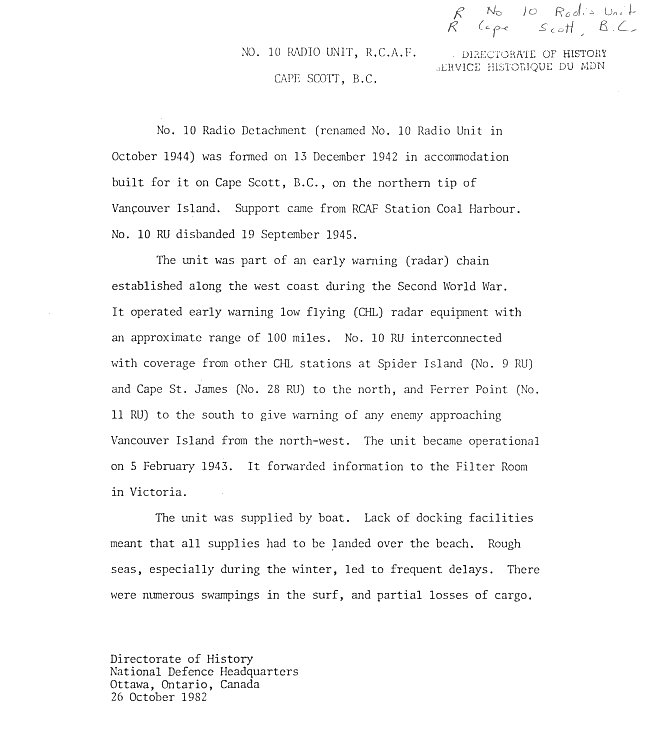
General detail pertaining to No 10 Radio Unit at Cape Scott - 26 October 1982.
Courtesy Mike Higgins.
The Cape Scott Story - April 1974.
Courtesy Assorted Sources.
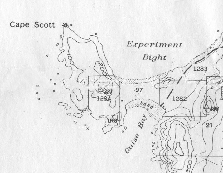
Map of the Cape Scott area - 1973.
Courtesy Mike Higgins.
Larger image of the map centering on the Cape Scott area - 1973.
Courtesy Mike Higgins.
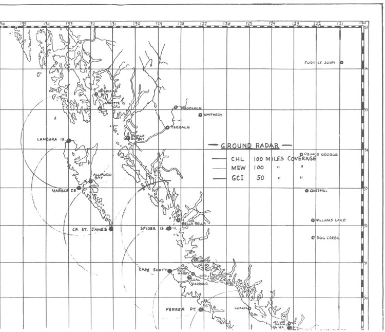
Map showing areas of radar coverage on the west coast - 1973.
Courtesy Mike Higgins.
Larger image of the map showing areas of radar coverage on the west coast - 1973.
Courtesy Mike Higgins.
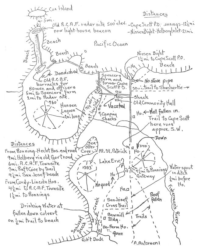
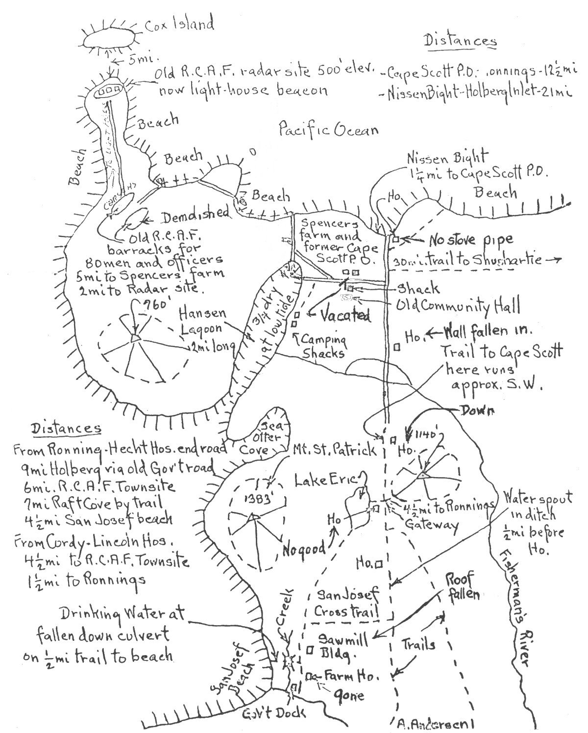
Hand drawn sketch showing facilities and the general area around Cape Scott - 1973.
Courtesy Mike Higgins.
Larger image of the Cape Scott area hand drawn sketch - 1973.
Courtesy Mike Higgins.
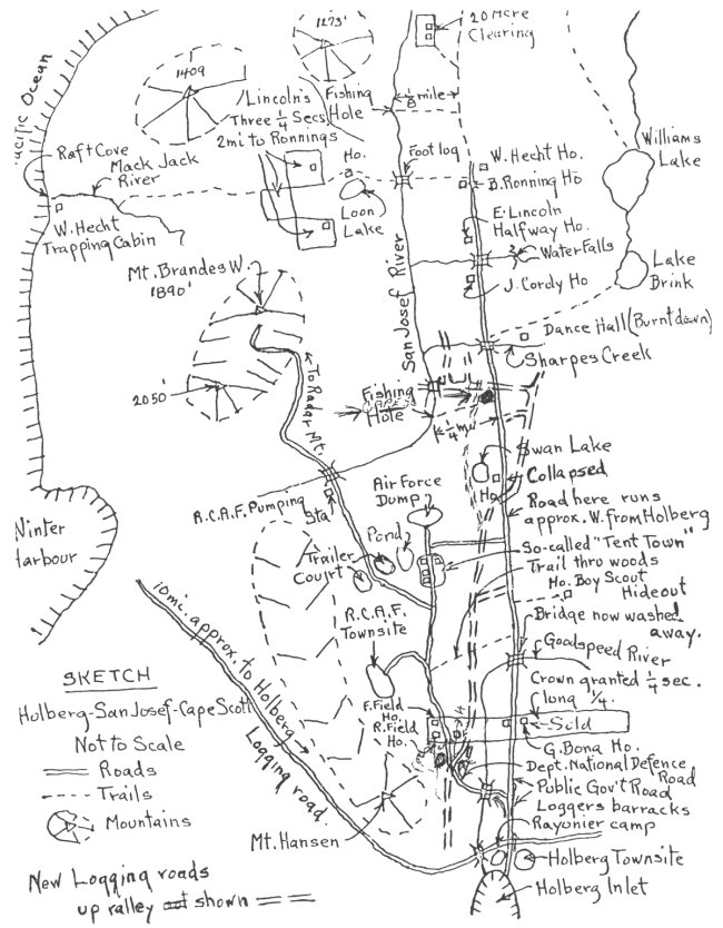
Hand drawn sketch showing facilities and the general area around Holberg - 1973.
Courtesy Mike Higgins.
Larger image of the Holberg area hand drawn sketch - 1973.
Courtesy Mike Higgins.
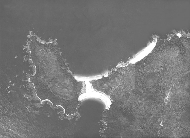
Aerial photo of the Cape Scott area - 29 April 1958.
Courtesy Mike Higgins.
Larger image of the aerial photo of the Cape Scott area - 29 April 1958.
Courtesy Mike Higgins.
Assorted photos and detail of Cape Scott - 1945.
Courtesy As Indicated.
Assorted photos and detail of Cape Scott - 1944.
Courtesy As Indicated.
Assorted photos and detail of Cape Scott - 1943.
Courtesy As Indicated.
Assorted photos and detail of Cape Scott - 1942.
Courtesy As Indicated.
About This Page
Updated: August 29, 2004