Click on the description text to view the detail.
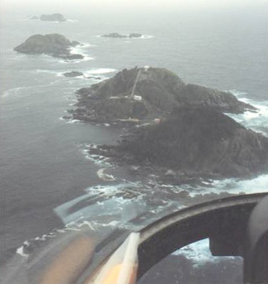
- Aerial photo of the Cape St. James complex - August 1989.
Courtesy Jim Durham-Reid.
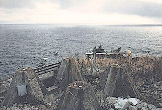
- Remains of the gantry which held the radar antenna in position - May 1986.
Courtesy Jim Durham-Reid.
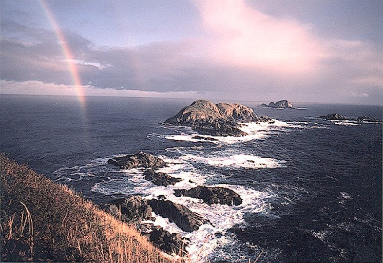
- One Mile Island (3/4 mile) where the RCAF, according to Harry Dow, planned to site the Ops Building, with a suspension bridge to St. James! R: Sealion Rocks (1-1/8 miles); Distant: Elephant Island (2-1/8 miles) - June 1985.
Courtesy Carol Dale via Jim Durham-Reid.
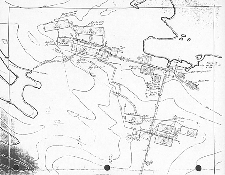
- Wartime site Plan #1 from the refit contractors files - May 1961.
Courtesy Jim Durham-Reid.
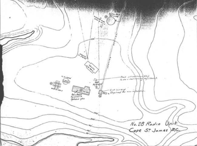
- Wartime site Plan #2 from the refit contractors files - May 1961.
# 10 was the radar gantry which was demolished in August 1945.
Courtesy Jim Durham-Reid.
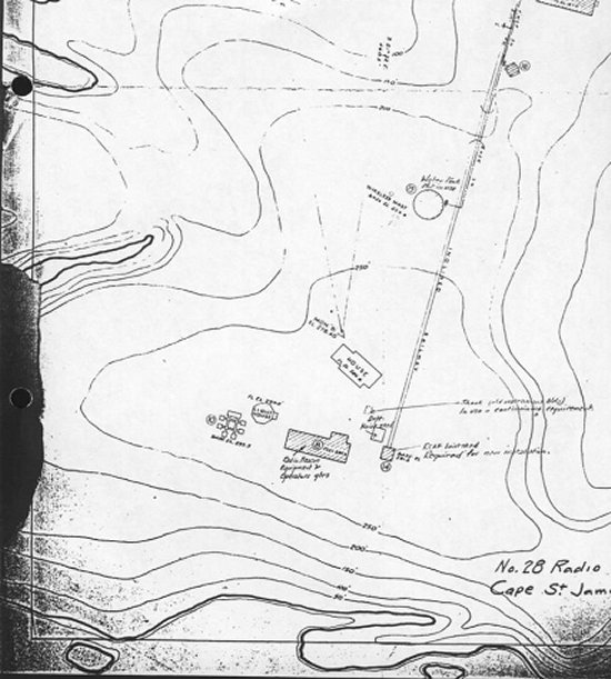
- Wartime site Plan #3 from the refit contractors files - May 1961.
Note - as these plans are marked "Radio Unit", they date from after September 1944, which was the time that the designation of the Radar Detachments (RD’s) was changed to Radar Units, (RU’s).
Courtesy Jim Durham-Reid.
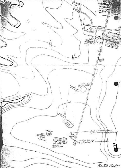
- Wartime site Plan #4 from the refit contractors files - May 1961.
Courtesy Jim Durham-Reid.
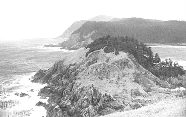
- Looking down from the top towards (N) the north hill and Kunghit Island - May 1961.
Courtesy Jim Durham-Reid.
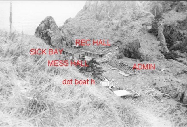
- Remains of the lower camp 16 years after the station was closed - May 1961.
Buildings are ground in position. The Rec Hall is upper left, the Sick Bay still stands, the Admin Building is flattened, rafters lie on roofless, the Mess Hall has collapsed and the DOT Boat House remains intact.
Courtesy Jim Durham-Reid.
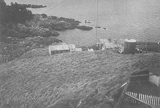
- View from the top of the lighthouse looking down and NNE - June 1960.
Old barracks area, still in use. Oil drums and water tank. 100’ radio mast. ‘Kitchen garden’ of the Keeper’s house lower right.
Courtesy Don Atkinson via Jim Durham-Reid.
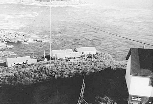
- Looking down tramway NNE towards old barrack area - June 1960.
Courtesy Don Atkinson via Jim Durham-Reid.
- View of original buildings as seen from the lighthouse - June 1954.
Courtesy Phylis Bowman via Jim Durham-Reid.
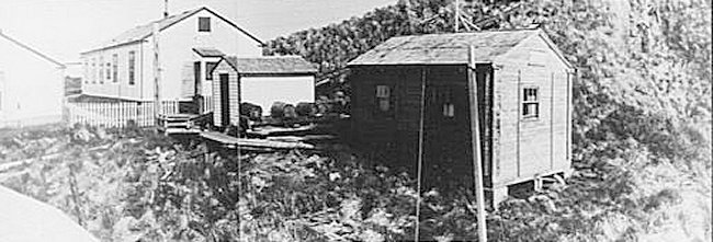
- These barracks and buildings were used by lighthouse personnel - June 1954.
Courtesy Phylis Bowman via Jim Durham-Reid.
- List of RCAF personnel known to have served at Cape St. James - 1943-1945.
Courtesy Jim Derham-Reid.
- Assorted photos and detail of Cape St. James Island - 1945.
Courtesy As Indicated.
- Assorted photos and detail of Cape St. James Island - 1944.
Courtesy As Indicated.
- Assorted photos and detail of Cape St. James Island - 1943.
Courtesy As Indicated.
- Assorted photos and detail of Cape St. James Island - 1942.
Courtesy As Indicated.
|