|
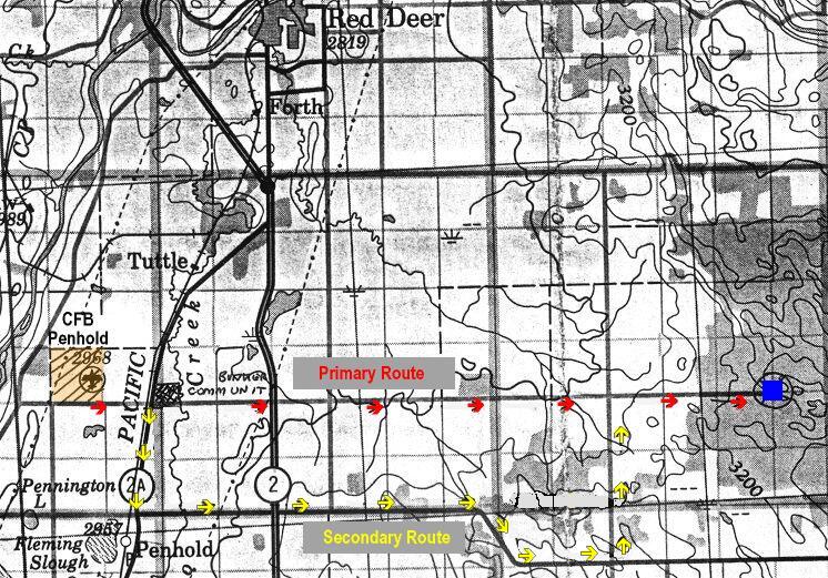
The radar station was located about 11 miles southeast of Red Deer, AB. There were two routes between CFB Penhold and the Operations complex. The direct (primary) route was 11 miles and the secondary route via Highway 42 was 16 miles. The reason for the two routes was that in the winter the direct route was hard to keep clear of snow and after a heavy rain in the summer it became a mud skating rink.
|