Click on the description text to view the photograph.
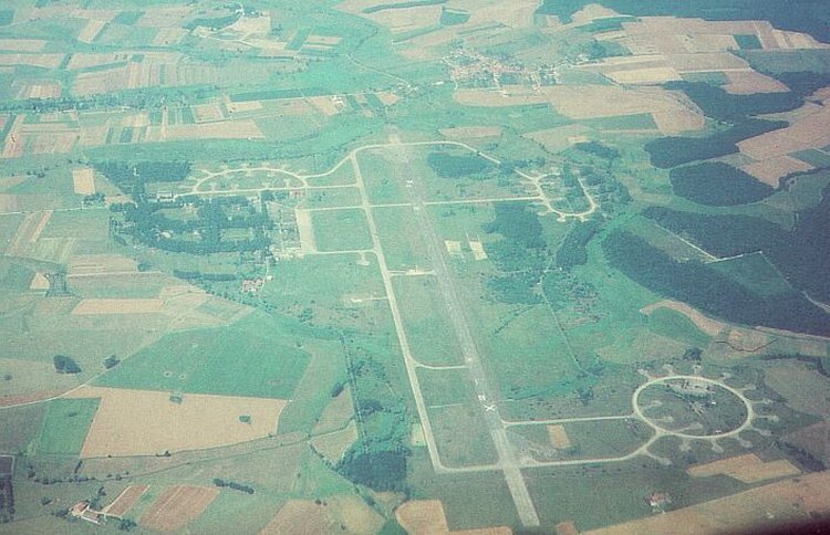
- Aerial photo of the airfield at Grostenquin - 1991.
This photo was taken by the Klaus Kropf, pilot of a B737, on approach to Saarbrucken airport.
Courtesy Klaus Kropf.
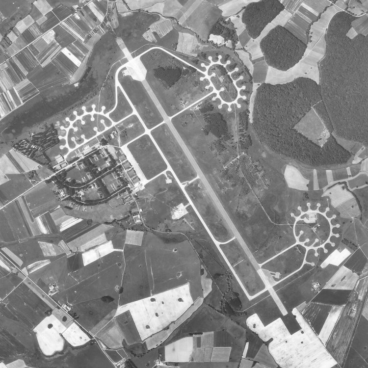
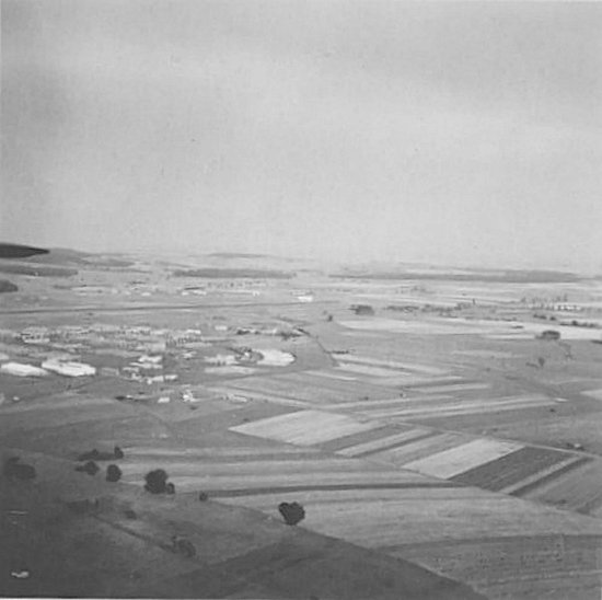
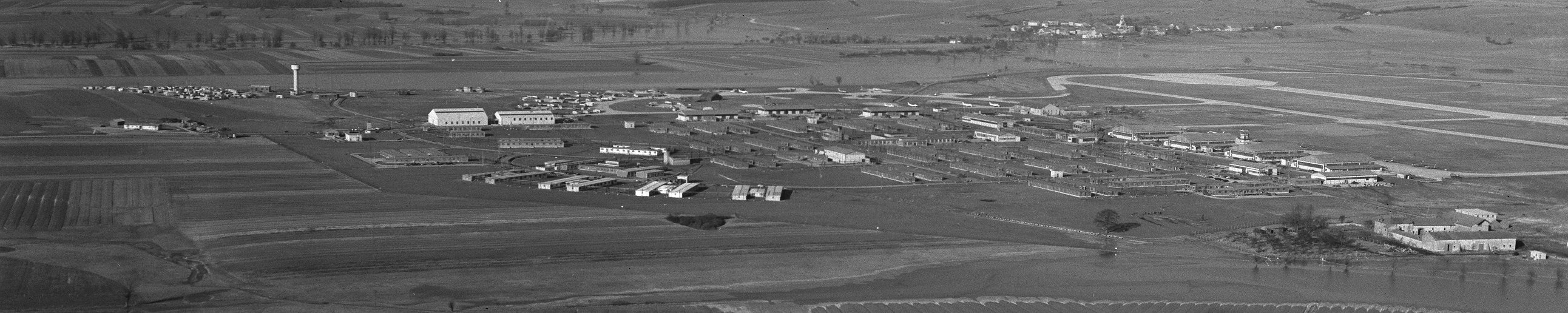
- Aerial photo of the airfield at Grostenquin - 1986.
Courtesy Ren L'Ecuyer.
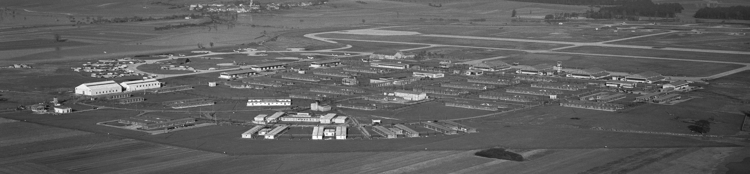
- Larger image of the aerial photo of Grostenquin - 1986.
Courtesy Ren L'Ecuyer.
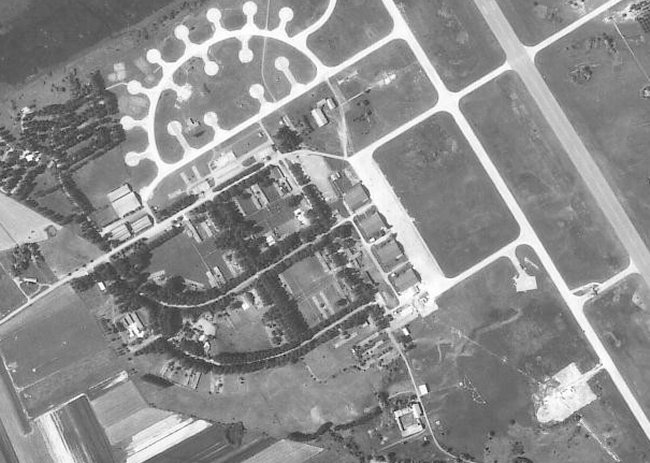
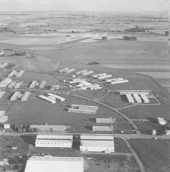
- Aerial photo of the domestic site at Grostenquin - 1986.
Courtesy Ren L'Ecuyer.
- Aerial photo of the domestic site at Grostenquin - 1986.
Courtesy Ren L'Ecuyer.
- Larger image of the domestic site photo - 1986.
Courtesy Ren L'Ecuyer.
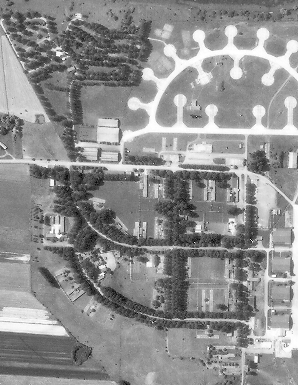
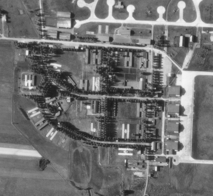
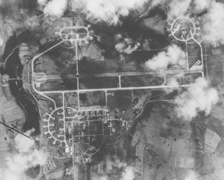
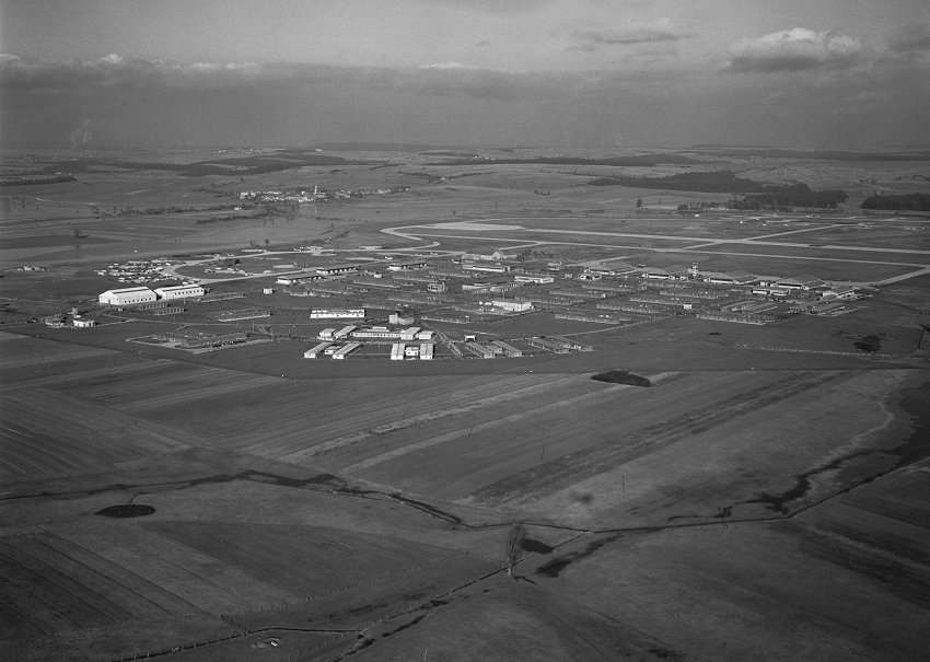
- Aerial photo of 2 Wing Grostenquin - 25 September 1970.
Note the size of the trees which are resulting in many dark shadows. The airfield has been closed for six years at this time and while there are a few buildings which no longer exist, the bulk of the domestic site remains as it was when the RCAF left the aerodrome in 1964.
Courtesy Ren L'Ecuyer.
- Larger image of the aerial photo of 2 Wing Grostenquin - 25 September 1970.
Courtesy Ren L'Ecuyer.
2 Wing Grostenquin is closed in July 1964
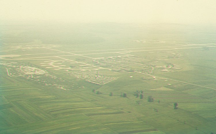
- Aerial photo of 2 Wing as seen from the northwest - April 1963.
Courtesy Dave Johnson.
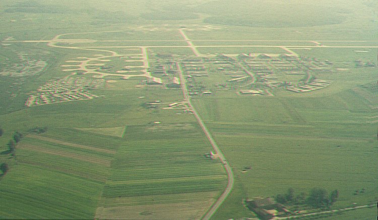
- Aerial photo of 2 Wing as seen from the west - April 1963.
Courtesy Dave Johnson.
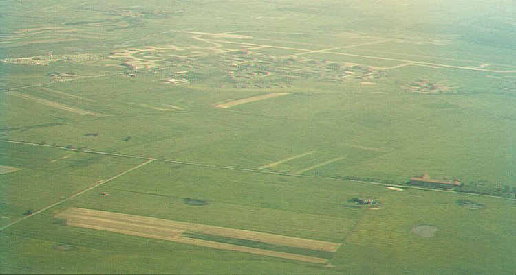
- Aerial photo of 2 Wing as seen from the southwest - April 1963.
Courtesy Dave Johnson.
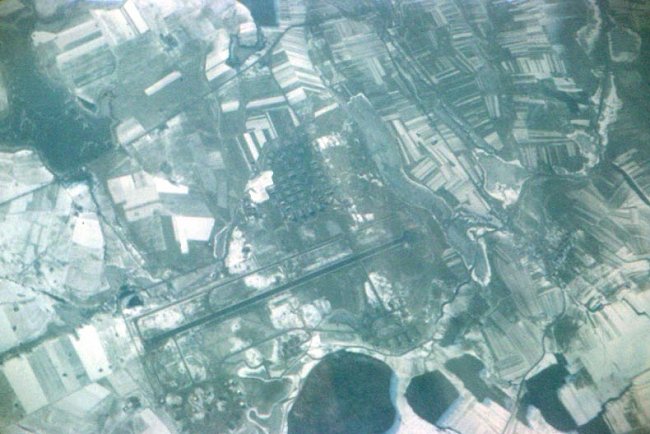
- Overhead aerial photo of RCAF Station Grostenquin - June 1961.
Courtesy Ren L'Ecuyer.
- Aerial photo of RCAF Station Grostenquin - June 1961.
Courtesy Ren L'Ecuyer.
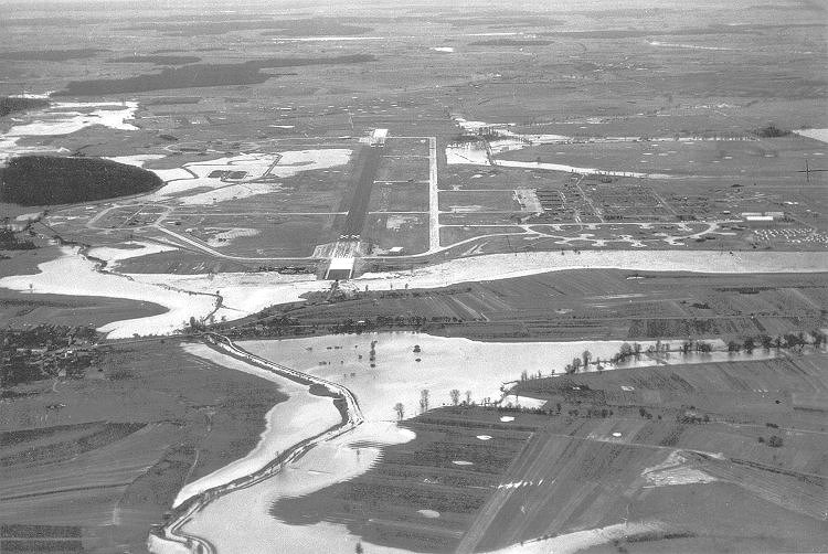
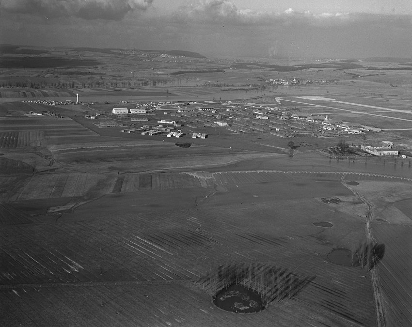
- Aerial photo of 2 Wing Grostenquin - 21 October 1960.
Note the flood conditions and the many surrounding World War II craters that have filled with water.
Courtesy Edward Mullen.
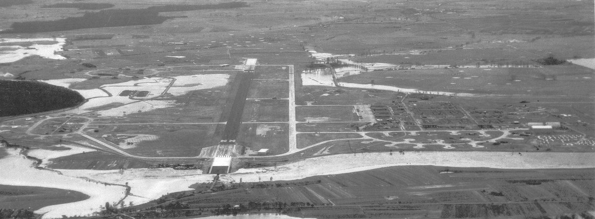
- Larger image of the aerial photo of 2 Wing Grostenquin - 21 October 1960.
Courtesy Edward Mullen.
- Aerial photo of RCAF Station Grostenquin - June 1960.
Courtesy Ren L'Ecuyer.
- Larger image of the aerial photo of RCAF Station Grostenquin - June 1960.
Courtesy Ren L'Ecuyer.
- Aerial photo of the station and the runway (center left) - May 1958.
Courtesy Jack Lightburn.
- Aerial photo of the station - May 1958.
Ice Arena, Swimming Pool and Recreation Center in foreground. Chapels, Hospital, Sr. NCOs & Officers Mess, and Offciers barracks.
Courtesy Jack Lightburn.
- Aerial photo of the station taken from a T-33 (Pilot F/O Kerr) - May 1955.
Courtesy Don Norrie.
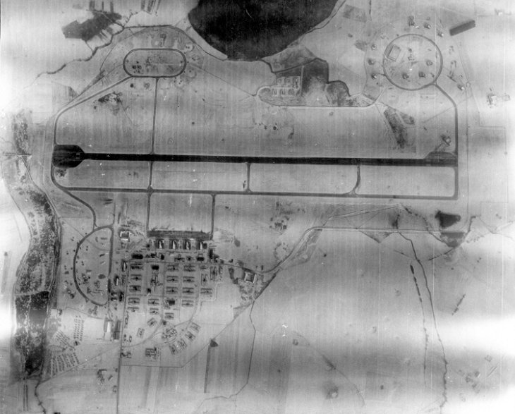
- Aerial photo of RCAF Station Grostenquin - 7 February 1955.
Courtesy Canadian Forces Joint Imagery Centre PL-81724.
- Larger image of the aerial photo of RCAF Station Grostenquin - 7 February 1955.
Courtesy Canadian Forces Joint Imagery Centre PL-81724.
- Aerial photo of RCAF Station Grostenquin - 7 February 1955.
Courtesy Canadian Forces Joint Imagery Centre PL-81725.
- Larger image of the aerial photo of RCAF Station Grostenquin - 7 February 1955.
Courtesy Canadian Forces Joint Imagery Centre PL-81725.
|