Click on the description text to view the photograph.
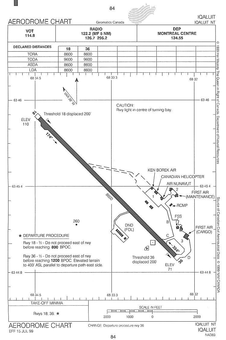
- Aerodrome chart for the original Frobisher Bay airport - 2004.
Courtesy Bill Cann.
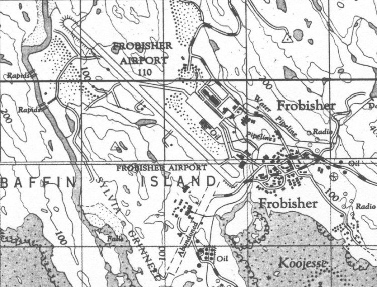
- Topogrpahical map of the Frobisher Bay airport - 1964.
Courtesy Department of Mines and Technical Surveys.
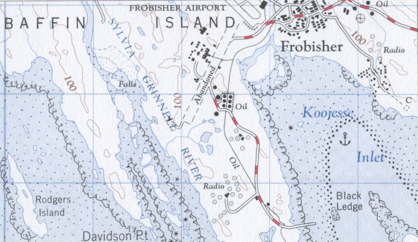
- Topographical map depicting a part of the Frobisher Bay airport - 1964.
Note the depiction of an abandoned runway.
Courtesy Department of Mines and Technical Surveys.
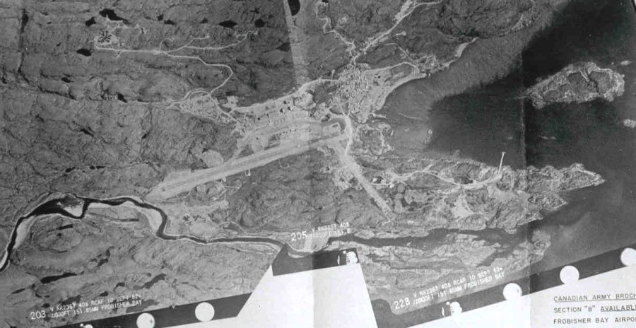
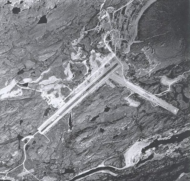
- Aerial photo of the airport and the surrounding area - 10 September 1962.
Courtesy Transport Canada.
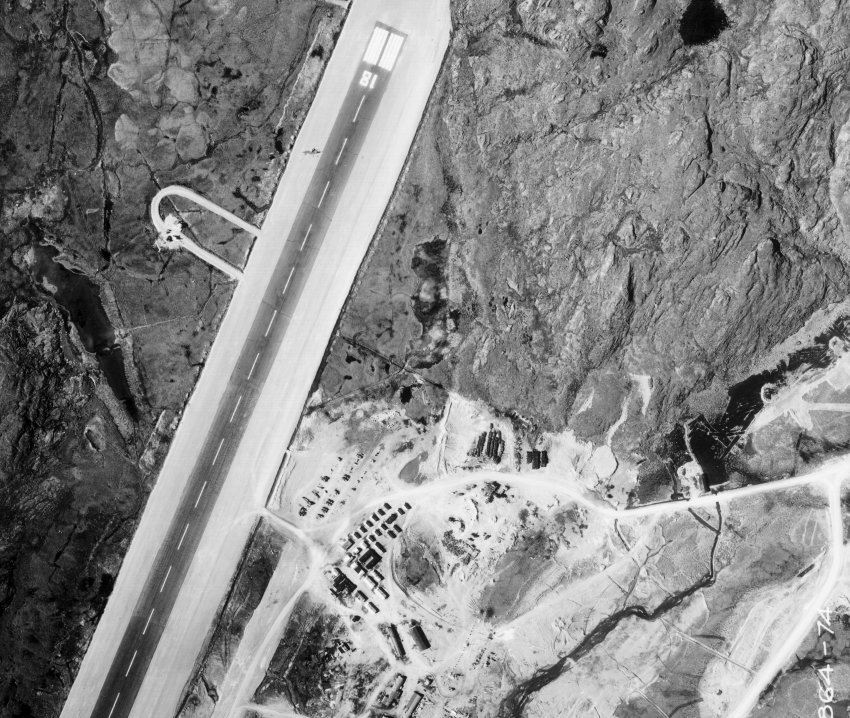
- Aerial photo of the airport and the surrounding area - 10 September 1962.
Courtesy Transport Canada.
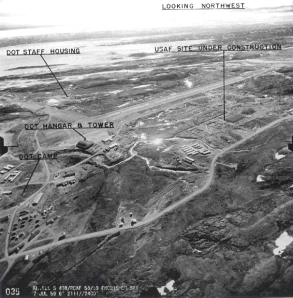
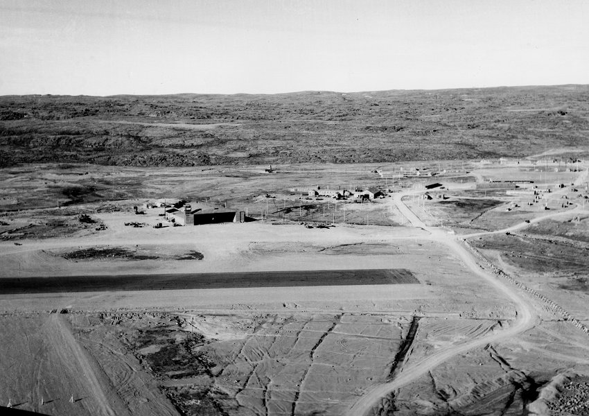
- Aerial photo of the Frobisher Bay airfield - 7 July 1959.
Courtesy Transport Canada.
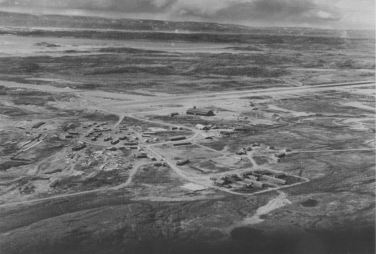
- Aerial view of the Frobisher Bay airfield - 27 September 1955.
Courtesy National Archives of Canada C-147255.
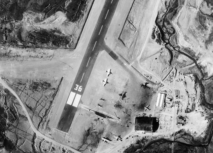
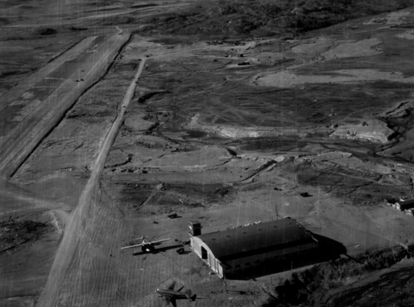
- Aerial view of the threshold to runway 36 and the main hangar - June 1955.
Courtesy National Archives of Canada.
- Aerial view of the threshold to runway 18 at Frobisher Bay - June 1955.
Courtesy National Archives of Canada.
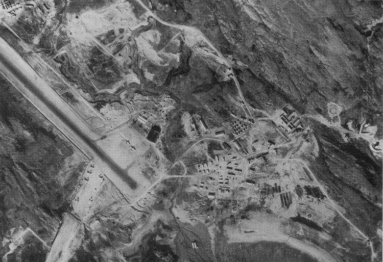
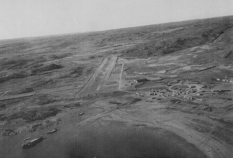
- Aerial view of the Frobisher Bay airbase - August 1953.
Courtesy Canadian Forces Photographic Unit.
- Aerial view of the Frobisher Bay airbase - 15 June 1950.
Courtesy Canadian Forces Photographic Unit REA-566-38.
- Aerial view of Crystal II airbase - May 1948.
Courtesy National Archives of Canada.
- Aerial view of Crystal II airbase - 20 March 1946.
Courtesy National Archives of Canada PL-164470.
|