Marville, France
Aerodrome Detail
Click on the description text to view the photograph.
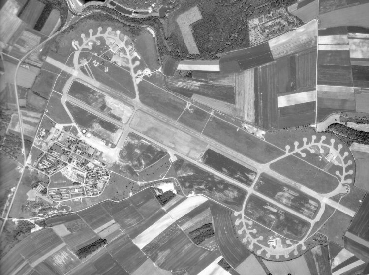
Aerial photo of the airfield at Marville - 1986.
Courtesy Ren L'Ecuyer.
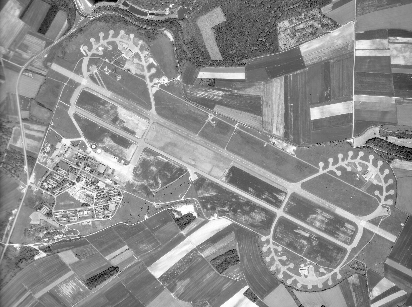
Larger image of the aerial photo of Marville - 1986.
Courtesy Ren L'Ecuyer.
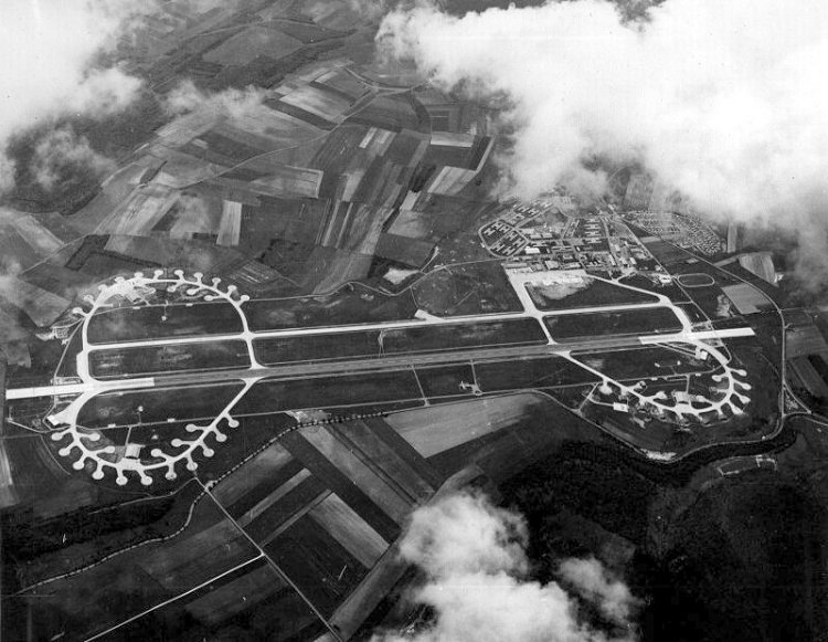
Aerial photo of the airfield at 1 Wing, Marville - August 1966
Courtesy of Bill Best
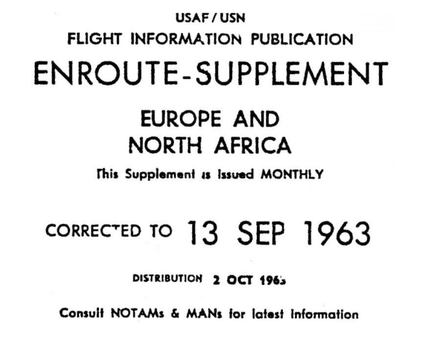
Enroute Supplement, cover page - 13 September 1963.
Courtesy Ren L'Ecuyer.
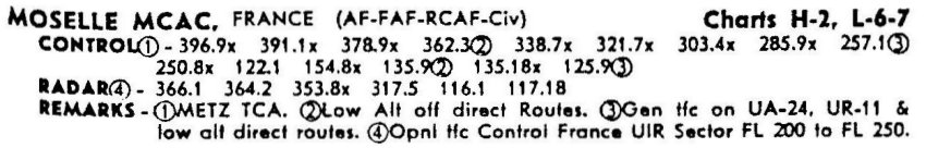
Moselle Control detail - 13 September 1963.
Courtesy Ren L'Ecuyer.
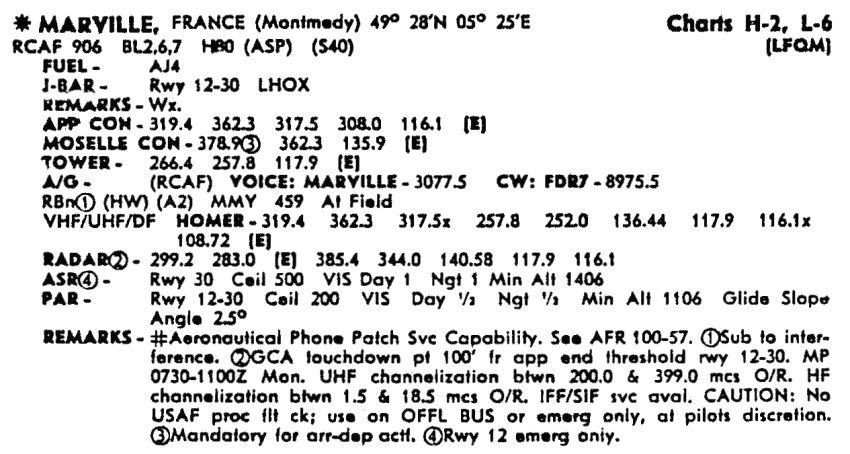
Marville aerodrome detail - 13 September 1963.
Courtesy Ren L'Ecuyer.
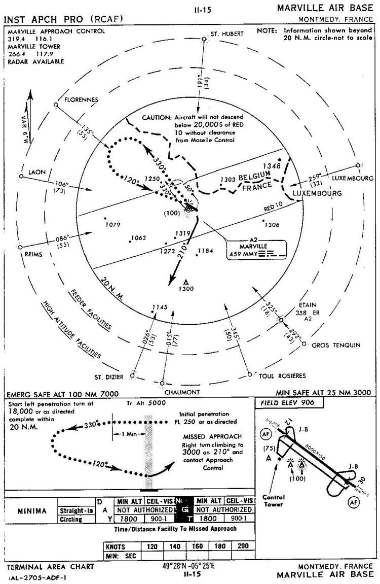
FLIP Chart. High Altitude ADF-1 Approach - 13 September 1963.
Courtesy Ren L'Ecuyer.
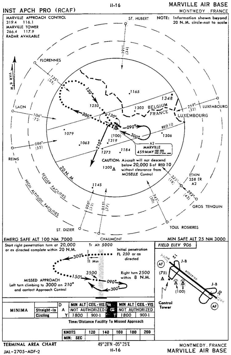
FLIP Chart. High Altitude ADF-2 Approach - 13 September 1963.
Courtesy Ren L'Ecuyer.
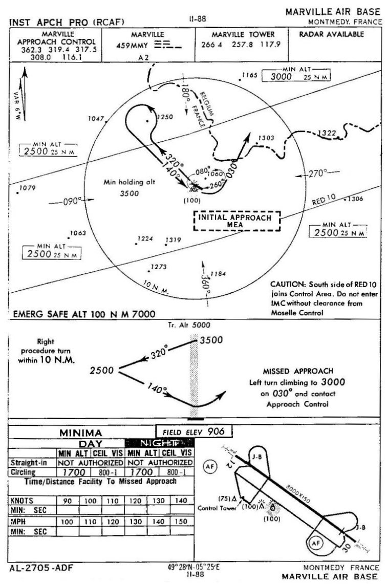
FLIP Chart. Low Altitude ADF Approach - 13 September 1963.
Courtesy Ren L'Ecuyer.
Photographic Credits
All photos are used with permission.
Return to the Details Page
Return to Top of Page
About This Page
Updated: November 7, 2004