Click on the description text to view the photograph.
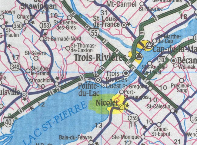
- Map showing the location of Nicolet south of Trois Rivieres - 29 May 2002.
Courtesy Ontario Ministry of Transportation.
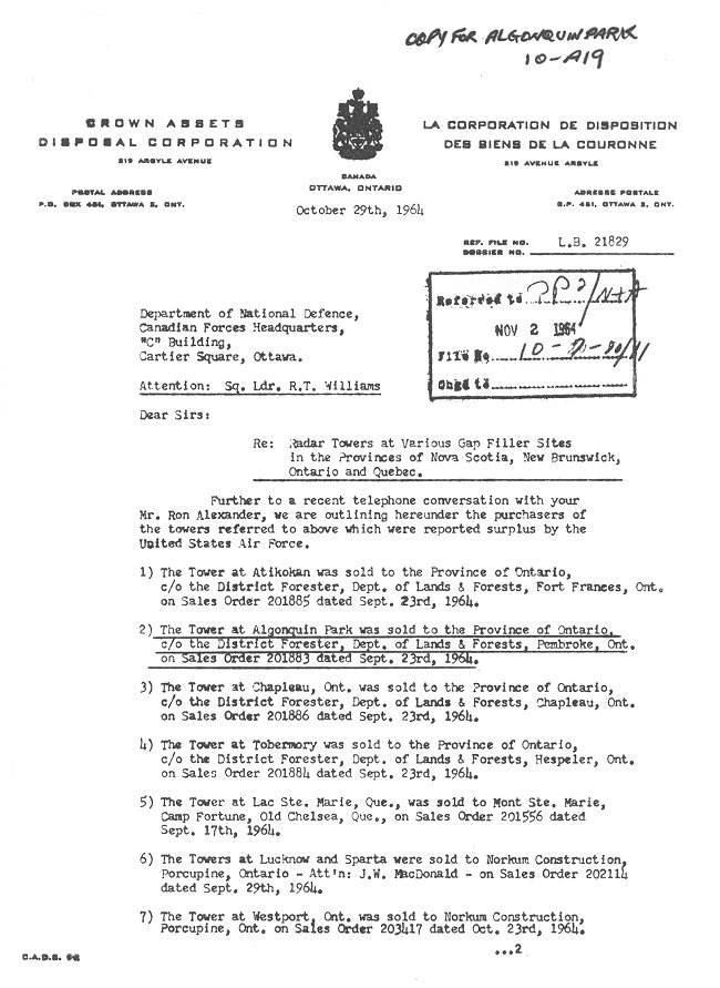
- Radar Towers at Gap Filler Sites, page 1 of 2 - 29 October 1964
Courtesy National Archives of Canada.
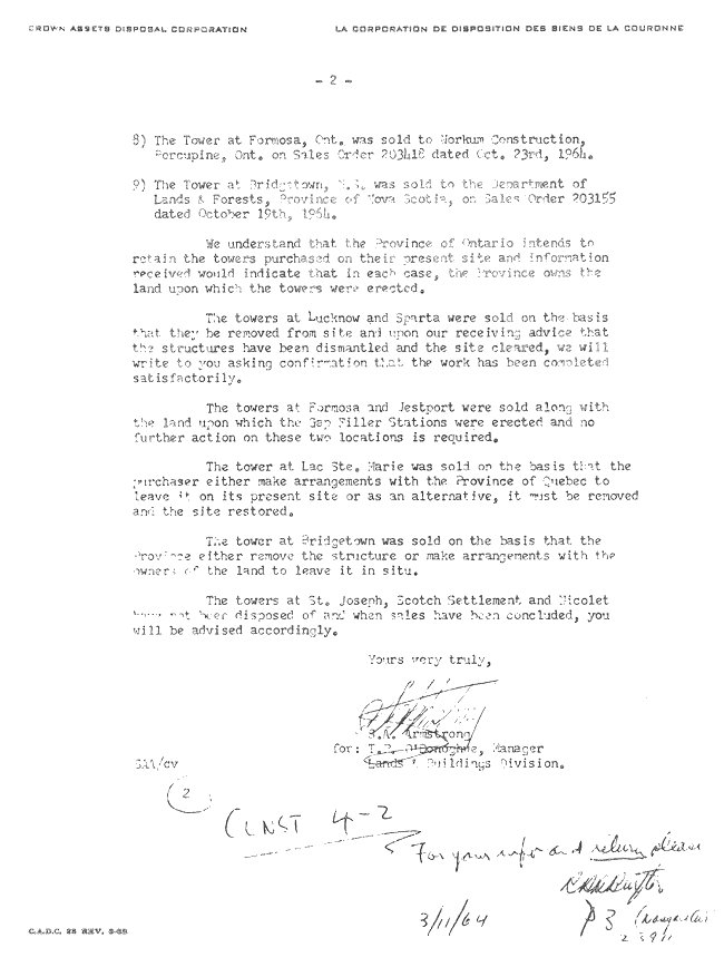
- Radar Towers at Gap Filler Sites, page 2 of 2 - 29 October 1964
Courtesy National Archives of Canada.
- Requirement for Farm Type Gate on Access Road - 24 June 1963
Courtesy National Archives of Canada.
- Care & Custody: Construction Status - 17 September 1962
Courtesy National Archives of Canada.
- Gap Filler Station: Nicolet - 8 August 1962
Courtesy National Archives of Canada.
- Gap Filler Station: Nicolet - 3 August 1962
Courtesy National Archives of Canada.
- Land Acquisition: Site & Access Road - 2 August 1962
Courtesy National Archives of Canada.
- Reservation of Armco Steelox Components - 2 May 1961
Courtesy National Archives of Canada.
- Preliminary CE Report & Cost Estimates - 1960
Courtesy National Archives of Canada.
- Field Surveys: Nicolet - 28 July 1959.
Courtesy National Archives of Canada.
|