Click on the description text to view the photograph.
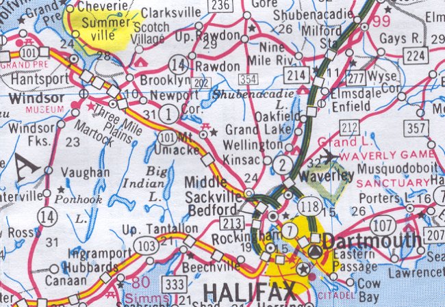
- Map showing the location of Summerville Centre northwest of Halifax - 29 May 2002.
Courtesy Ontario Ministry of Transportation.
- Disposal of Property - 27 May 1964
Courtesy National Archives of Canada.
- Memorandum on Project Status - 17 January 1964
Courtesy National Archives of Canada.
- Requirement for Farm Type Gate on Access Road - 24 June 1963
Courtesy National Archives of Canada.
- Care & Custody: Construction Status - 17 September 1962
Courtesy National Archives of Canada.
- Gap Filler Station: Summerville - 8 August 1962
Courtesy National Archives of Canada.
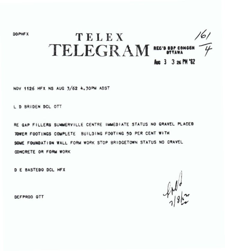
- Construction of Gap Filler Radar Station at Summerville - 3 August 1962
Courtesy National Archives of Canada.
- Land Acquisition: Site & Access Road - 2 August 1962
Courtesy National Archives of Canada.
- CADIN Construction Approval - 7 September 1961
Courtesy National Archives of Canada.
- Reservation of Armco Steelox Components - 2 May 1961
Courtesy National Archives of Canada.
- Detail pertining to the Gap Filler site at Summerville Centre - 31 March 1961
Courtesy National Archives of Canada.
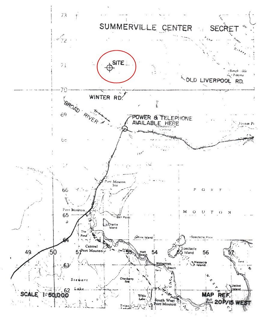
- Map showing the proposed location of the Gap Filler site at Summerville Centre - 31 March 1961
Courtesy National Archives of Canada.
- Adler River: Field Survey - 11 August 1959
Courtesy National Archives of Canada.
|