Click on the description text to view the photograph.
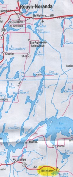
- Map showing the location of Belleterre south of Rouyn-Noranda - 29 May 2002.
Courtesy Ontario Ministry of Transportation.
- CADIN Gap Filler Program - 1 November 1963
Courtesy National Archives of Canada.
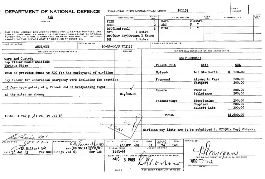
- Care & Custody: Belleterre - 19 July 1963
Courtesy National Archives of Canada.
- Farm Type Gate: Belleterre - 12 July 1963
Courtesy National Archives of Canada.
- Requirement for Farm Type Gate on Access Road - 24 June 1963
Courtesy National Archives of Canada.
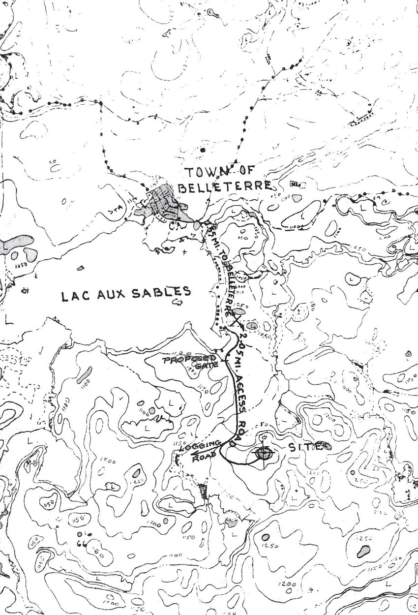
- Map of Belleterre and the local area - 8 May 1963.
Courtesy National Archives of Canada.
- Care & Custody: Construction Status - 17 September 1962
Courtesy National Archives of Canada.
- Gap Filler: Belleterre - 9 August 1962
Courtesy National Archives of Canada.
- Land Acquisition: Site & Access Road - 2 August 1962
Courtesy National Archives of Canada.
- Status Report on Belleterre - 31 July 1962
Courtesy National Archives of Canada.
- Reservation of Armco Steelox Components - 2 May 1961
Courtesy National Archives of Canada.
- Preliminary CE Report & Cost Estimates - 20 April 1960
Courtesy National Archives of Canada.
- Forestry Tower near Belleterre - 14 March 1960
Courtesy National Archives of Canada.
- Forestry Tower near Belleterre - 5 February 1960
Courtesy National Archives of Canada.
- Forestry Tower near Belleterre - 3 February 1960
Courtesy National Archives of Canada.
- Programme for Gap Filler Radar Sites - 14 October 1958
Courtesy National Archives of Canada.
|