Click on the description text to view the photograph.
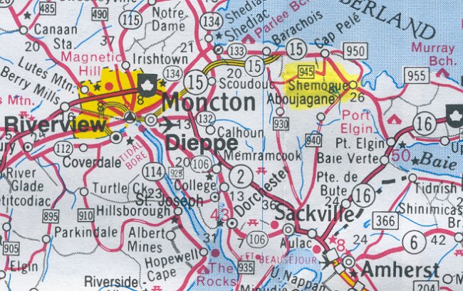
- Map showing the location of Shemogue east of Moncton - 29 May 2002.
Courtesy Ontario Ministry of Transportation.
- Reservation of Armco Steelox Components - 2 May 1961
Courtesy National Archives of Canada.
- Detail pertining to the Gap Filler site at Shemogue - 31 March 1961
Courtesy National Archives of Canada.
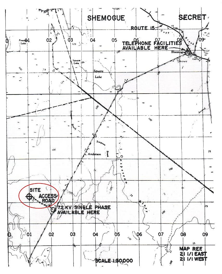
- Map showing the proposed location of the Gap Filler site at Shemogue - 31 March 1961
Courtesy National Archives of Canada.
- Foresty Tower at Mount Carleton - 10 May 1960
Courtesy National Archives of Canada.
- Forestry Tower at Mount Carleton - 14 March 1960
Courtesy National Archives of Canada.
- Forestry Tower at Mount Carleton - 9 March 1960
Courtesy National Archives of Canada.
- Mount Carleton - 24 February 1960
Courtesy National Archives of Canada.
- Forestry Tower at Mount Carleton - 8 February 1960
Courtesy National Archives of Canada.
- Forestry Tower at Mount Carleton - 8 February 1960
Courtesy National Archives of Canada.
- Field Survey: Gap Filler Station Mt Carlton - 28 January 1960
Courtesy National Archives of Canada.
- Gap Filler Field Survey: Mt Carlton - 20 January 1960
Courtesy National Archives of Canada.
- Field Surveys: Mt Carlton - 11 September 1959
Courtesy National Archives of Canada.
|