Atikokan, ON
Gap Filler Site
Click on the description text to view the photograph.
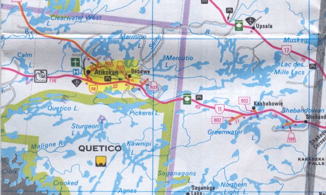
Map showing the location of the Atikokan Gap Filler site - 29 May 2002.
Courtesy Ontario Ministry of Transportation.
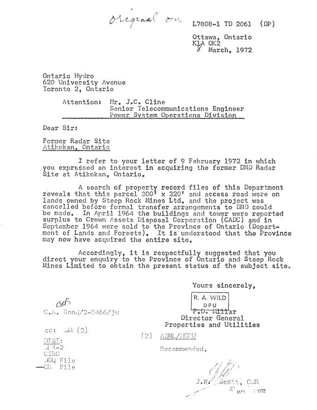
Former Radar Site - 8 March 1972
Courtesy National Archives of Canada.
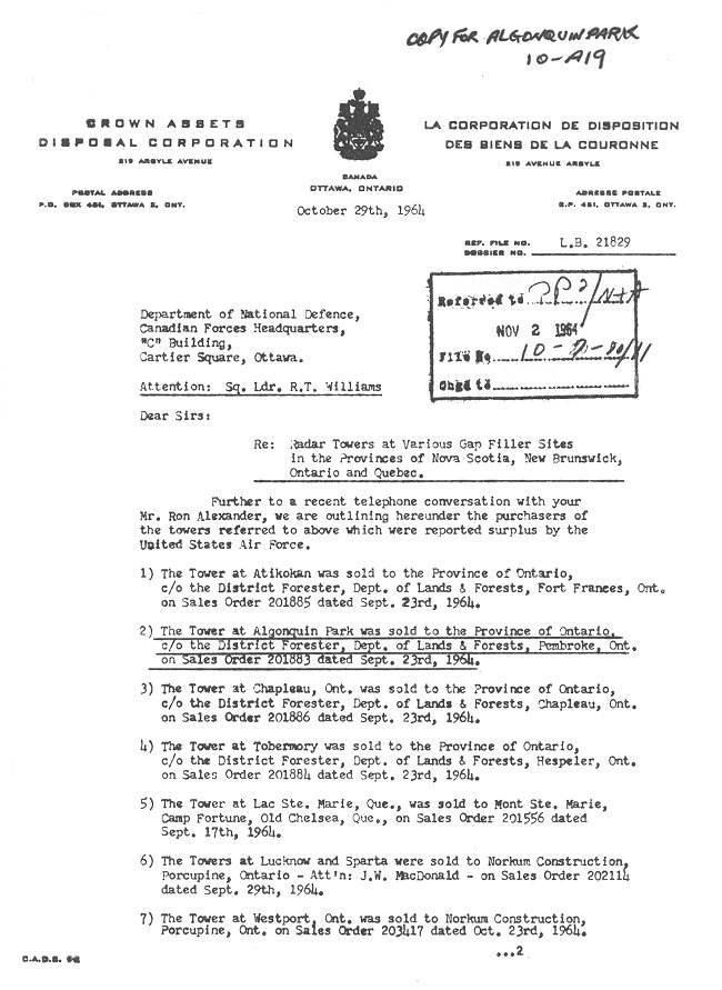
Radar Towers at Gap Filler Sites, page 1 of 2 - 29 October 1964
Courtesy National Archives of Canada.
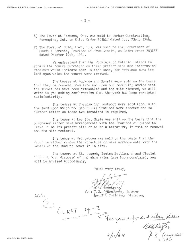
Radar Towers at Gap Filler Sites, page 2 of 2 - 29 October 1964
Courtesy National Archives of Canada.
CADIN Gap Filler Program - 1 November 1963
Courtesy National Archives of Canada.
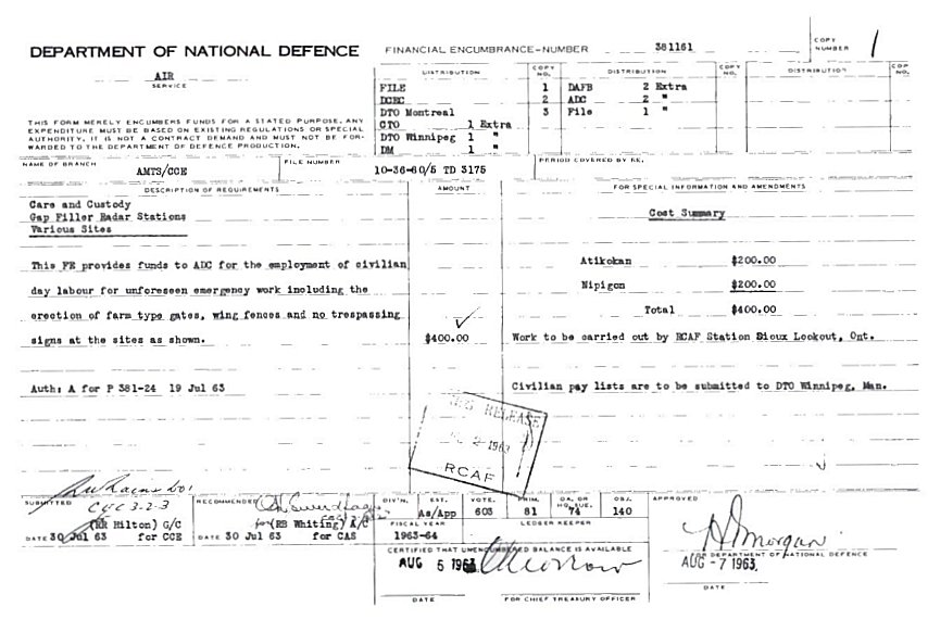
Care & Custody: Atikokan - 19 July 1963
Courtesy National Archives of Canada.
Requirement for Farm Type Gate on Access Road - 24 June 1963
Courtesy National Archives of Canada.
Care & Custody - 14 May 1963
Courtesy National Archives of Canada.
Care & Custody - 5 May 1963
Courtesy National Archives of Canada.
Care & Custody: Construction Status - 17 September 1962
Courtesy National Archives of Canada.
Gap Filler: Atikokan - 8 August 1962
Courtesy National Archives of Canada.
Gap Filler Station: Atikokan - 3 August 1962
Courtesy National Archives of Canada.
Land Acquisition: Site & Access Road - 2 August 1962
Courtesy National Archives of Canada.
Reservation of Armco Steelox Components - 2 May 1961
Courtesy National Archives of Canada.
Preliminary CE Report & Cost Estimates - 1960
Courtesy National Archives of Canada.
Field Surveys Requirements: Atikokan - 24 July 1959.
Courtesy National Archives of Canada.
Field Surveys: Atikokan - 17 July 1959.
Courtesy National Archives of Canada.
Photographic Credits
All photos are used with permission.
Return to the Details Page
Index
E-mail
Return to Top of Page
About This Page
This page is located at
http://www.pinetreeline.org/gap/prcaf/cg17.html
Updated: January 7, 2005